Ground penetrating radar (GPR) is a non‑invasive tool. It helps you see what lies beneath the surface, without excavation. Whether you want to map subsurface structures, detect underground utilities, or study subsurface objects, GPR gives you a clear view. Let’s break down how ground penetrating radar works, from the basic theory to the hardware, data handling, and field use.
The Theory Behind GPR
At its heart, ground penetrating radar theory relies on electromagnetic energy. A GPR unit sends out short radar pulses into the ground. These waves move until they hit a boundary in the subsurface, such as a pipe or void. When that happens, part of the wave bounces back. A receiver antenna picks up this reflected signal. By tracking the time and strength of that return, we build a map of subsurface layers and features.
Key principles include:
- Electromagnetic properties of materials affect wave travel.
- Dielectric properties, like dielectric permittivity, determine wave speed.
- Electrical conductivity can absorb energy and weaken the return.
- Signal attenuation limits how deep we can see.
The differences in those reflections show us what lies below. That’s how GPR turns invisible underground zones into visible data.
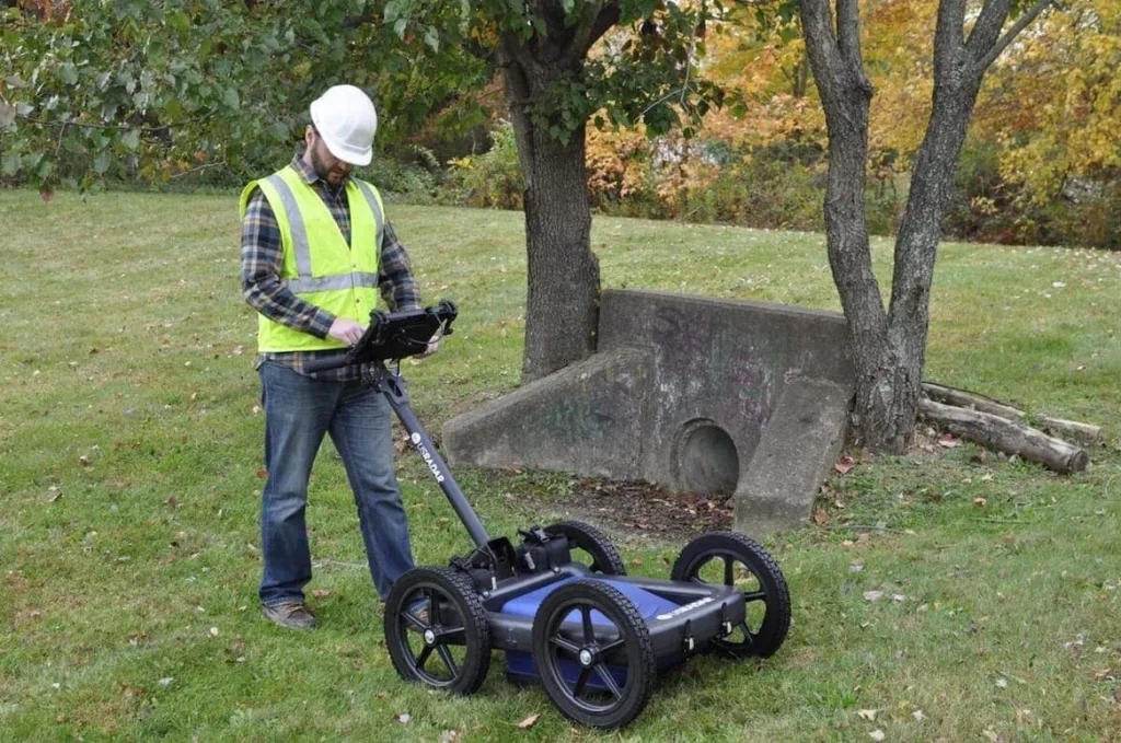
Main Parts of a GPR System
A working ground penetrating radar system includes several parts:
- Transmitter antenna – It emits the electromagnetic pulse.
- Receiver antenna – It catches the returning radar signal.
- Control unit – It times the transmissions, handles signals, and does initial data logging.
- Display/storage system – It presents radar profiles for data interpretation.
Some setups add GPS, offering precise location tracking during GPR surveys. Other systems pair with seismic tools or electromagnetic sensors for more insight.
When combined, this GPR equipment gives operators a portable, reliable radar scanner.
What GPR Reveals Underground

GPR technology picks up contrasts in underground material. It can detect:
- Buried structures, like foundation footings.
- Pipes, cables, and other underground utilities.
- Voids, sinkholes, or subsurface anomalies.
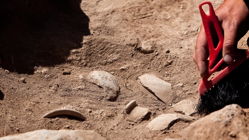
- Archaeological artifacts and buried objects.
- Layered subsurface layers and soil zones.
- Features inside concrete structures, like rebar or conduits.
The more abrupt the boundary, the clearer the reflection. Smooth, uniform soil gives poor contrast. In those cases, combining GPR with other methods helps.
Factors That Shape GPR Performance
Not all conditions work equally well. Several factors affect scan quality:
- Soil conditions: Sandy, dry soils allow deeper scans. Clay or wet ground has high conductivity and absorbs radar energy.
- Frequency range: Higher frequencies show finer detail but shallow reach. Low-frequency antennas go deeper but blur small objects.
- Dielectric permittivity: Changes in that property help create visible signals.
- Target size & shape: Larger or uniform objects reflect more clearly.
- Signal attenuation: This limits maximum penetration depth, especially in conductive soils.
GPR operators weigh these variables to match their job goals to the right setup.
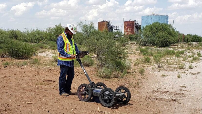
The GPR Method in the Field

Here’s how a typical GPR scan goes:
- Operators lay out a grid pattern.
- They push or tow the GPR unit over the site.
- The transmitter antenna sends pulses into the soil.
- The receiver antenna catches each return signal.
- The control unit logs each waveform and distance.
- Multiple passes build a 2D or 3D visual model.
These maps show likely subsurface features. That makes further digging or planning safer and smarter.
Professionals use ground penetrating radar surveys for many tasks:
- Mapping utilities before excavation.
- Inspecting concrete structures.
- Conducting subsurface investigations in archaeology or civil work.
- Studying soils in geotechnical surveys.
- Searching for voids in roads and bridges.
Turning Waves into Answers
Raw GPR data isn’t useful until we process it. Here’s where data processing and data interpretation come in:
- Signal filtering removes noise.
- Gain controls amplify weak reflections.
- Profiles convert travel time to actual depth calculations.
- Analysts study waveform shape, strength, and depth to label features.
- Layers get mapped and compared to known electromagnetic properties.
Publications like Geophysical Research Letters often share case studies of good GPR results that saved time and money.
![]()
Pairing GPR with Other Detection Technologies
Combining GPR with other methods improves results:
- Electromagnetic methods trace metal pipes or conductivity contrasts.
- Seismic waves help with soil stiffness and layer boundaries.
Electromagnetic induction detects metallic objects. - Ground disturbances, like trenches, show up more clearly with combined data.
This teamwork gives a fuller picture, especially in complex sites.
Strengths of Ground Penetrating Radar
GPR offers several advantages:
- Non‑destructive: It sees without breaking the ground.
- Real‑time: You spot features as you scan.
- Cost‑effective: It cuts back on surprises and rework.
Flexible: It works for everything from archaeology to utility location. - Safe: It emits low‑power electromagnetic pulses.
With the right frequency range, antennas, and analysis, GPR exposes buried threats or opportunities.
Where GPR Has Limits
GPR works well, but not everywhere. Some limits:
- High electrical conductivity soils reduce depth.
- Mixed or cluttered subsurface layers muddy pictures.
- Shallow depths only work with high frequencies.
- Evaluation needs trained GPR operators and good data interpretation.
- Large natural layers (wet clays) can block deep signals.
Despite these challenges, GPR is one of the most powerful geophysical methods available.
Real-World Uses of GPR
Here are specific ways GPR makes a difference:
| Field | Application |
| Construction | Locate underground utilities before digging. Prevent damage. |
| Infrastructure | Scan roads and bridges for voids inside concrete. |
| Archaeology | Map old walls or graves without digging. |
| Environmental | Identify soil layers or contamination zones. |
| Engineering | Measure ground moisture, density, or mechanical traits. |
| Surveys | Use GPR surveys to check ice thickness or groundwater zones. |
Each case uses the same tools, GPR antennas, waves, and interpretation, to serve different goals.
A Step-by-Step GPR Walkthrough
Putting it all together:
- Site prep: Clear debris and mark grid lines on the ground surface.
- Pick antennas: High frequency for detail, low for depth.
- Scan: Move the GPR unit in straight lines across the grid.
- Monitor: Operators watch data in real time.
- Data capture: The control unit logs each waveform.
- Process: Apply filters and conversions.
- Interpret: Spot subsurface anomalies, layers, or objects.
- Report: Share maps, images, and findings.
Well‑run GPR lets you make accurate, data‑backed decisions – without digging blind.
Final Thoughts
Now you know how ground penetrating radar works in real life. By combining smart hardware, strong theory, and careful data processing, GPR gives clear insight beneath the surface. You can locate pipes, find buried structures, and map soils—all without breaking ground.
With clear steps, smart operators, and the right gear, GPR becomes a safe, reliable tool for spotting what’s hidden. When used alongside electromagnetic induction, seismic techniques, or other geophysical tools, it opens a new window into the subsurface world.
Whether your need is public safety, project planning, or archaeology, understanding how ground penetrating radar works helps you take confident, informed steps. And that pays dividends, from time saved to risks avoided.