
Grave Location and Cemetery Mapping with GPR
Ground-penetrating radar transforms cemetery management by revealing unmarked graves, mapping burial grounds, and documenting historic cemeteries with precision that traditional methods can’t match. Whether you’re managing a historic cemetery with incomplete records, searching for lost graves, or planning expansion in existing burial space, GPR technology provides non-invasive subsurface imaging that protects sacred spaces while delivering accurate documentation.
Why Choose US Radar for Grave Location and Cemetery Mapping
US Radar has served cemetery managers, archaeologists, and local community organizations with advanced GPR systems since 1994. Our ground-penetrating radar equipment is designed for immediate use—simply power on, auto-calibrate to soil conditions, and start scanning. You can operate our systems confidently from day one, collecting data and identifying burial locations without specialized expertise or complex setup procedures.
What sets our systems apart is simplicity combined with superior technology. Our triple-frequency range ground-penetrating radar (GPR) delivers clearer subsurface imaging than single-frequency GPR equipment that may miss shallow, unmarked burials or lack depth penetration for older graves. The automatic processing displays real-time underground views as you scan, making it easy to identify disturbed soil patterns and grave locations in real time.
Our Ground-Penetrating Radar Products
GPRover Utility Mapping System
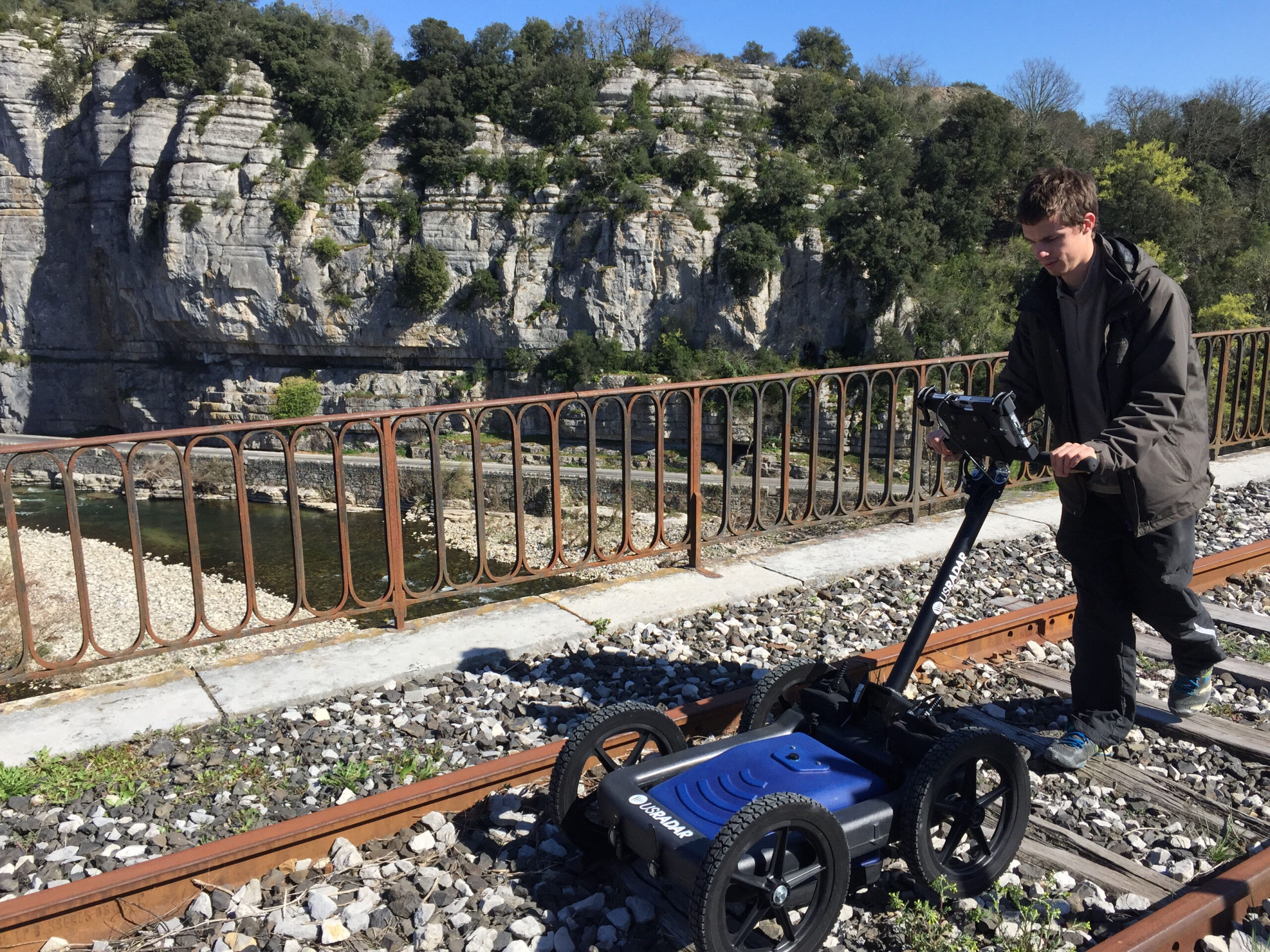
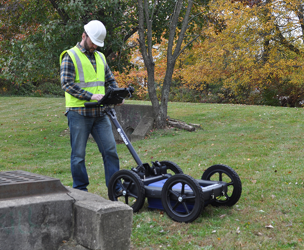
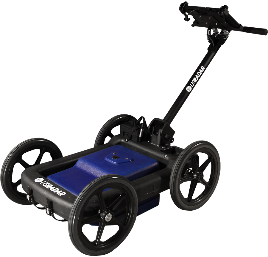
The GPRover is ideal for comprehensive cemetery mapping projects requiring both subsurface imaging and precise GPS coordinates. This ground-penetrating radar system combines triple-bandwidth technology with global GPS connectivity to create burial plot maps in real time. With the ability to detect buried objects in shallow, unmarked graves and in burials up to 30 feet deep, the GPRover automatically handles diverse cemetery conditions and soil types.
The system requires no base station or control points, providing accuracy within 2 inches out of the box. Patented slope-correction technology compensates for uneven terrain common in historic cemeteries, including headstones, monuments, and landscape features. You’ll see subsurface grave markers displayed on-screen as you scan, with automatic data collection that creates as-built maps ready for export to mapping software.
What it delivers:
- Real-time GPS mapping of grave locations
- Triple frequency imaging for all depths
- Automatic processing with immediate results
Quantum Imager Triple Frequency GPR System
The Quantum Imager is the first true triple-frequency-range GPR system ever produced, offering unsurpassed resolution for cemetery surveys. The antenna emits three separate signals simultaneously, generating three independent datasets that provide confident identification of unmarked burials. This quantum imaging method creates clearer, easier-to-understand underground views than older radar technologies, making it straightforward to locate individual graves in areas with complex soil chemistry or tree roots.
The system detects everything from wooden coffins to concrete vaults, while providing the required depth penetration for historic cemeteries. Automatic processing handles soil conditions variations across the site, displaying burial locations and disturbed soil patterns in real time without requiring technical interpretation. You can identify graves, mark locations, and document the cemetery’s history efficiently across the entire survey area.
System advantages:
- Three independent datasets for verification
- Automatic adjustment to soil chemistry
- Clear displays for immediate grave identification
Q Series GPR Systems
The Q Series offers versatile ground-penetrating radar options for cemetery management projects with specific requirements and budgets. These systems deliver clear imaging and reliable subsurface detection for cemetery surveys, from shallow grave locations to moderate-depth investigations. The Q10 high-frequency system excels at identifying shallow, unmarked graves and recent burials in the topsoil. The Q25 provides clear imaging of subsurface anomalies at moderate depths, making it effective for mapping burial grounds with known depth ranges.
All Q Series systems feature automatic calibration and straightforward operation that anyone can perform confidently. The systems automatically adapt to local soil conditions, displaying subsurface features as you scan, without complex settings or technical knowledge.
Series capabilities:
- Budget-friendly options for cemetery surveys
- Automatic soil calibration for easy operation
- Clear displays showing burial locations immediately
Common Grave Location and Cemetery Mapping Challenges
| Challenge | What It Looks Like | How We Help |
|---|---|---|
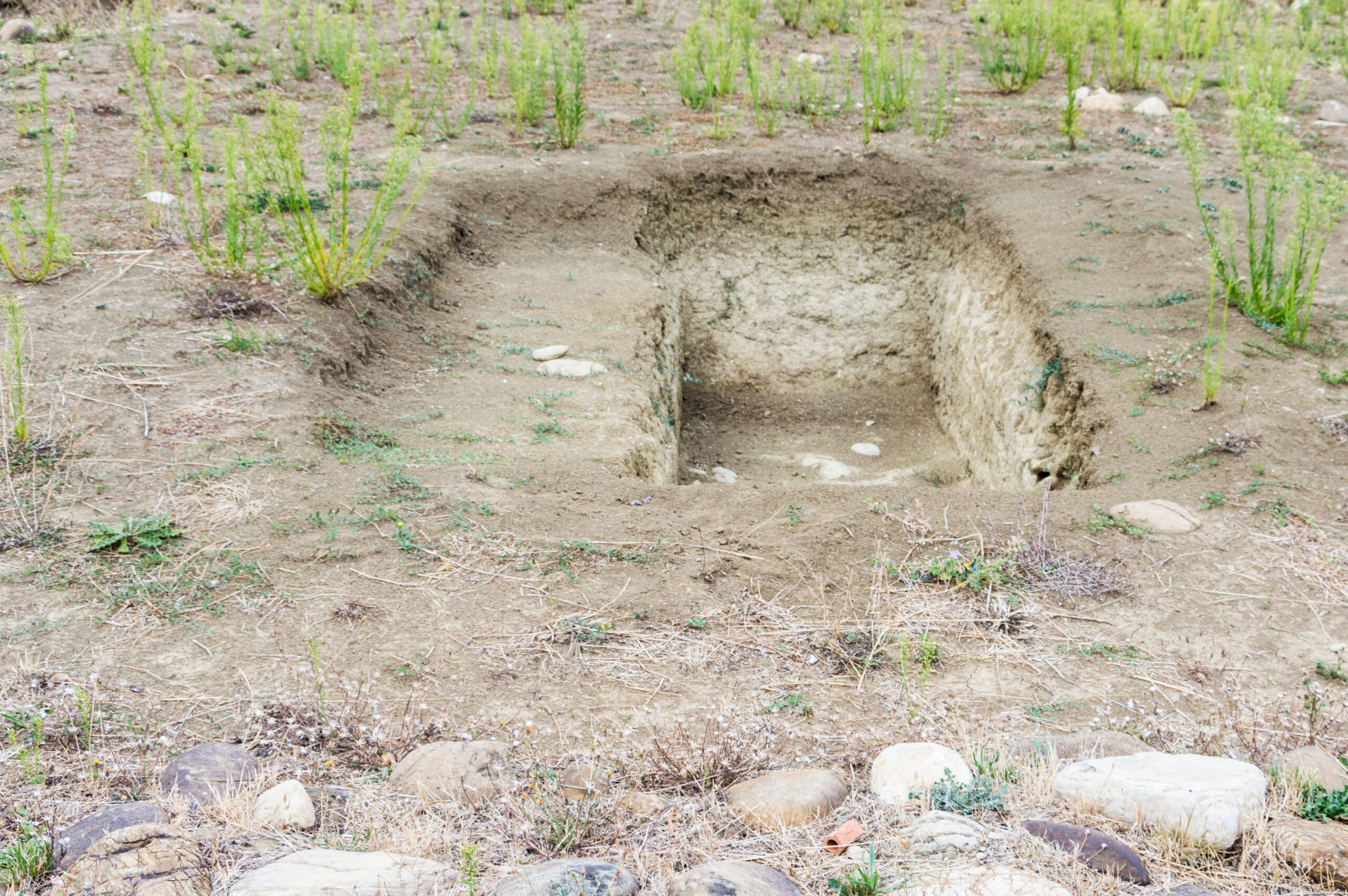
| Unmarked Graves in Historic Cemeteries | Burial grounds with lost graves, missing headstones, or unknown graves from past centuries create uncertainty about actual grave locations and available burial space for future generations. | Our triple-frequency systems detect burial-related soil disturbance and remains at depths up to 30+ feet, revealing unmarked burials that surface surveys miss. Automatic processing displays disturbed soil patterns clearly for immediate identification. |
| Complex Soil Chemistry | Tree roots, utility lines, changes in soil chemistry, or high moisture content create subsurface noise that complicates grave identification with standard GPR equipment. | The Quantum Imager’s three independent datasets allow automatic cross-comparison to distinguish actual burials from natural soil variations and underground anomalies. The system handles these challenges automatically. |
| Incomplete Cemetery Documentation | Aging burial records with inaccurate plot numbers, missing historical documentation, or hand-drawn maps that don’t align with current landscape features complicate cemetery management and family research. | Our GPS-integrated systems create accurate burial plot maps with precise coordinates, exportable to Google Earth and GIS platforms for permanent digital documentation that preserves the cemetery’s history for future generations. |
| Non-Invasive Survey Requirements | The need to locate graves without excavation, protect sacred burial grounds from invasive techniques, and maintain respect for remains while gathering essential data. | Ground-penetrating radar provides non-invasive subsurface imaging, revealing grave locations and burial depths without disturbing soil or requiring excavation, preserving the integrity of burial sites and open spaces. |
| Wooden Coffin Detection | Wood coffins decompose over time, creating subtle subsurface voids and soil disturbance that are challenging to detect, particularly in older sections of historic cemeteries. | Our advanced GPR technology automatically detects characteristic soil-disturbance patterns and voids associated with wooden coffin decomposition, displaying these features clearly even in challenging soil conditions or at significant depths. |
| Cemetery Expansion Planning | Determining available burial space in existing cemeteries requires identifying all grave locations, including unmarked burials, to avoid disturbing existing graves during expansion into open spaces. | Comprehensive cemetery surveys using our GPR equipment automatically map both marked and unmarked graves across the survey area, providing the data needed for safe expansion planning and accurate space management. |
Frequently Asked Questions
How much does a cemetery mapping ground-penetrating radar system cost?
Cost depends on the required depth penetration, GPS capabilities, and software packages. The GPRover and Quantum Imager include premium software and offer triple-frequency technology essential for confident grave location across varying soil conditions. Contact us for specific pricing based on your cemetery survey requirements and the size of burial grounds you need to map.
What makes US Radar different from other GPR providers for cemetery work?
We’re the only manufacturer offering true triple frequency range technology, which generates three independent datasets for cross-comparison when identifying unmarked graves and burial locations. Our systems are designed and built in the USA with input from professionals conducting cemetery surveys worldwide, ensuring practical features like patented slope correction for uneven terrain and automatic processing that displays results immediately. What truly sets us apart is ease of use—our systems feature automatic calibration and real-time displays that allow anyone to operate them confidently, identifying grave locations and documenting burial sites without specialized expertise.
Can ground-penetrating radar distinguish between graves and other underground anomalies?
Yes. GPR data reveals characteristic patterns that help identify burials versus utility lines, tree roots, or natural voids. Graves typically show rectangular soil disturbance patterns, potential coffin reflections, and specific depth signatures. Our systems automatically process these signals and display subsurface features clearly on screen. The three independent datasets from the Quantum Imager provide automatic cross-comparison for verification, making it straightforward to recognize burial-related patterns versus other subsurface features.
How deep can GPR detect graves and burial sites?
Our ground-penetrating radar systems detect graves from surface level down to 30+ feet, with the 100 Series reaching depths up to 100 feet for specialized applications. Detection depth depends on soil conditions, moisture content, and the burial type. Wooden coffins create subtle soil disturbance patterns detectable even after decomposition, while concrete vaults provide strong reflections. The triple frequency technology in our GPRover and Quantum Imager systems maintains resolution across all depth ranges, automatically adjusting to soil chemistry and conditions across the site.
How do I know if I need GPS integration for cemetery mapping?
If you’re creating accurate burial plot maps for documentation, planning expansion, or need to tie grave locations to existing landscape features and headstones, GPS integration is essential. The GPRover provides accuracy within 2 inches without requiring base stations, making it ideal for comprehensive cemetery mapping projects. The system creates as-built maps showing burial locations with precise coordinates that can be exported to Google Earth and mapping software. For projects focused solely on identifying potential grave locations in a small survey area without creating georeferenced maps, systems without GPS may be sufficient.
Can I start using US Radar systems immediately for cemetery surveys?
Yes. Our ground-penetrating radar equipment features automatic calibration that adjusts to soil conditions when you power on. Simply connect the battery, turn on the system, let it auto-calibrate to the ground, and start scanning. The display shows subsurface features in real time as you collect data across the cemetery. You’ll see disturbed soil patterns, potential grave locations, and burial sites displayed on screen immediately. No complex system settings or technical knowledge required—the automatic processing handles soil chemistry variations, moisture content, and other factors as you scan.
Can GPR work in cemeteries with lots of tree roots and vegetation?
Yes. Our ground-penetrating radar systems work effectively in vegetated areas. The automatic processing distinguishes between tree root patterns and burial-related soil disturbance, displaying both clearly so you can identify actual grave locations. Our patented slope correction technology also compensates for uneven terrain and landscape features common in historic cemeteries with mature vegetation. The triple frequency technology helps differentiate between natural subsurface features and actual burials automatically.
How accurate are GPR-based cemetery maps?
The GPRover system provides GPS accuracy of 2 inches (5cm) for burial plot mapping, sufficient to create detailed as-built maps and tie grave locations to existing landscape features, headstones, and markers. GPR depth measurements are typically accurate within several inches, depending on soil conditions. This level of precision supports cemetery management decisions, expansion planning based on available burial space, and documentation that preserves the cemetery’s history for future generations, while maintaining the technology’s non-invasive nature.
What information can ground-penetrating radar reveal about unmarked graves?
Ground-penetrating radar reveals the location, approximate depth, and size of potential grave sites based on soil disturbance patterns and subsurface anomalies. GPR data can indicate whether a concrete vault is present based on reflection characteristics and identify voids associated with the decomposition of wooden coffins in the subsurface. The systems display these features clearly in real time, creating an underground view showing where unmarked burials exist. This supports cemetery documentation and helps avoid accidental disturbance during ground work or excavation for new burials.
How long does a typical cemetery GPR survey take?
Survey duration depends on cemetery size, desired level of detail, and terrain conditions across the site. A small family cemetery might be surveyed in a few hours, while comprehensive mapping of large burial grounds could take several days of data collection. The GPRover’s real-time GPS mapping capabilities and automatic processing significantly speed up the process. Our systems auto-calibrate to soil conditions, eliminating complex setup procedures and enabling efficient scanning across the entire survey area to locate unmarked graves and document all burial locations.
Use GPR for Grave Location and Cemetery Mapping Today
Let us help you start your grave location or cemetery mapping project the right way. We will make sure you find the right radar system.