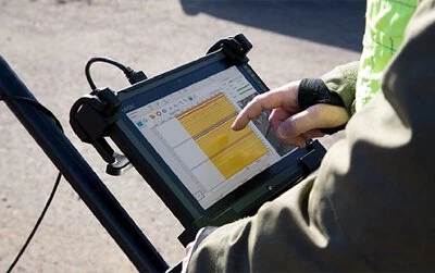
Radar Studio is a comprehensive software suite for viewing and processing radar data. It features an infinitely customizable user interface with intuitive controls and functions. Users can transform the data collected through our Acquisition Software into dynamic visuals that can be shared and stored for later use.
This software is an optional addition to your system. It is full compatible with the data generated by our Acquisition Software. We especially recommend this software for users wanting to create highly visual representations of their findings; such as 3D images and maps.
Features
GPS Data & Mapping
Data Processing
3D Imaging
Annotation
File Exports
Depth Slices
GPS Data & Mapping
Data Processing
3D Imaging
Annotation
File Exports
Depth Slices
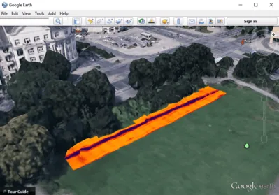
GPS Data & Mapping
Integrate GPS data seamlessly to create dynamic, visual maps that add environmental context to your findings.
Data Processing
Radar Studio offers many data processing options designed to improve data interpretation. The automatic settings allow for new users to instantly get usable results with only minimal training.
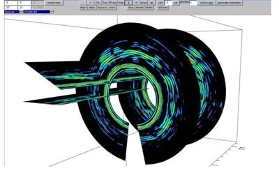
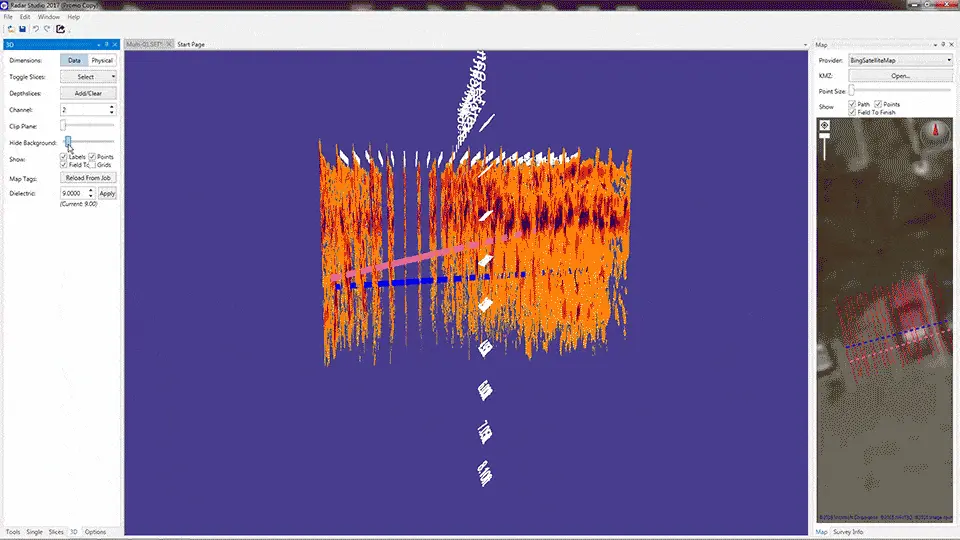
3D Imaging
Radar Studio offers advanced 3D imaging that allows the user to precisely calibrate velocity and depth. Plain view images are displayed in the mapping window and changes are updated in real time.
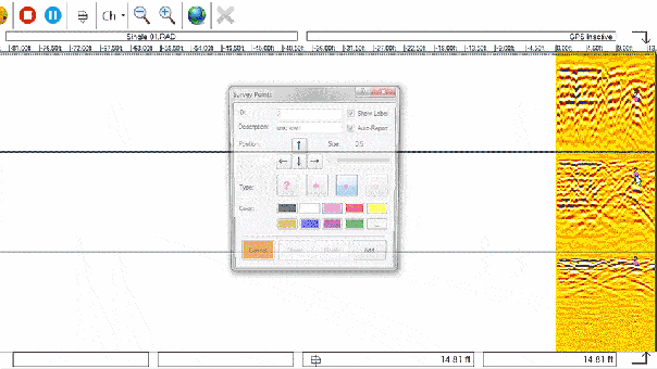
Annotation
Context clues are vital to utility location, which is why annotation is built right into the interface. With Radar Studio, you can easily add notes, select color codes, and choose icons to be displayed on the data and in the map window. Additionally, lines can be drawn in the map window to represent utilities.
File Exports
Export your finished product into a wide variety of different file formats. This can range from automatically generated reports as well as advanced CAD and Google Earth Files.
Depth Slices
Create depth slices to add greater visual context to your findings and bring your data to life.
Is Radar Studio Right for Your Needs?
Do you want to know if this solution will suit your specific needs? Contact us and one of our team members will help determine the best GPR software solutions for you.