Proven, Reliable, Rugged.
GPR That Gets the Job Done.
For more than 30 years, US Radar has manufactured ground-penetrating radar (GPR) systems that deliver unsurpassed depth penetration and resolution for any subsurface investigation. From utility locating and structural assessment to archaeological and ground surveys, our GPR equipment provides the data quality and depth capabilities professionals need to work confidently in the field.
Explore Some of Our GPR Products
Browse US Radar's full range of GPR systems, designed for unparalleled accuracy and reliability in subsurface imaging with solutions tailored to a variety of industries and applications.
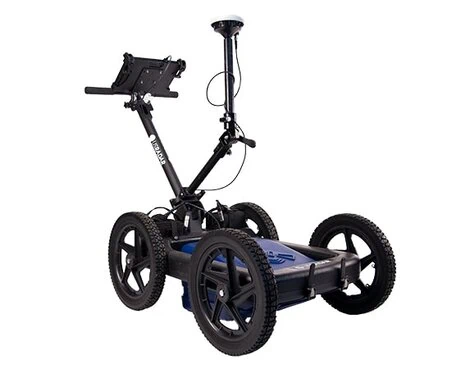
Quantum Imager Triple Frequency GPR
Quantum Imager Triple Frequency GPR
The first true triple-frequency-range GPR system ever produced. The Quantum Imager emits three separate signals across multiple antenna frequencies simultaneously, generating three independent datasets for superior data interpretation. With direct RF sampling, GPS mapping, and auto-calibration to get you scanning in minutes, this system delivers precise data for utility locating, archaeological, and structural assessment applications.
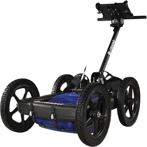
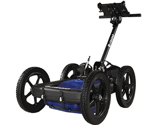
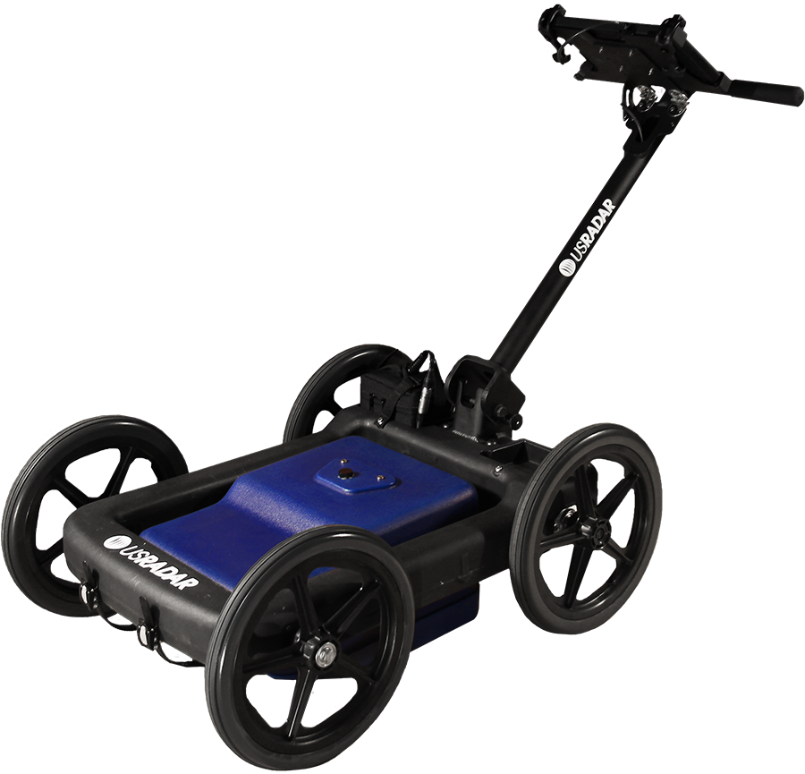
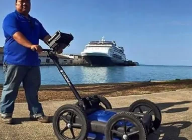
GPRover
GPRover
US Radar’s most popular GPR system for utility mapping, combining triple bandwidth ground-penetrating radar technology with precision GPS connectivity. The GPRover creates subsurface maps in real time with accuracy within 2 inches (5cm), requiring no base station or control points. Patented slope correction technology compensates automatically for uneven terrain.
Q Series Systems
Q Series Systems

What is Ground-Penetrating Radar (GPR)?
GPR is a non-destructive geophysical method that uses electromagnetic waves to image the Earth’s subsurface. It is a powerful tool that allows engineers, geologists, archaeologists, and other professionals to collect detailed information about the subsurface without invasive techniques, like drilling or excavation.
This tool works by transmitting radio waves into the ground using a transmitter antenna. These waves then travel through the subsurface, reflecting off objects and layers with different physical properties. The reflected waves are then received by a receiver antenna, which records the time and amplitude of the reflected signals. By analyzing these signals, GPR can create a 2D or 3D image of the subsurface.
Overall, this is a cost-effective and efficient method that can be used in a wide range of applications, from assessing the condition of concrete structures to mapping the subsurface for geological studies. This opens up a new realm of possibilities for subsurface exploration and imaging, allowing professionals to collect detailed information in a methodical manner.
Why US Radar?
US Radar is a leading ground-penetrating radar manufacturer committed to staying at the forefront of GPR technology. With over 30 years of field experience, every GPR system we produce is designed and built in the USA for operators who need powerful subsurface imaging that’s simple to use from day one.

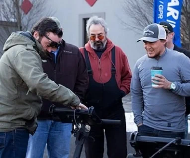
Technology Innovated By the Field, For the Field
We manufacture GPR equipment informed by the real-world experience of professionals in the field. Every design decision is driven by end users and global customer feedback, so our ground-penetrating radar systems solve the challenges operators actually face during GPR scans and subsurface investigations.

Deliverable Data in
Real-Time
Our Radar Acquisition Software automatically calibrates the GPR antenna to surrounding soil conditions and displays the results as you scan. GPR data can be marked, labeled, saved, and shared immediately, improving project efficiency and eliminating delays before field decisions can be made.
Unsurpassed Depth and Resolution
Our GPR technology detects subsurface objects and buried utilities at depths other systems can’t reach (up to 30+ feet with most models and up to 100 feet with the 100 Series). Triple frequency technology provides superior imaging across the full frequency range, delivering greater penetration depth without sacrificing resolution.

Award-Winning Hardware and Software
From the quality of materials to the functionality of the software ecosystem, excellence is evident in every product. Weather-resistant Getac tablets, up to 8 hours of battery life, and rigid airless tires ensure reliable performance. Data processing and 3D visualization transform raw radar data into actionable deliverables.

Easy-to-Use and Customizable Systems
Operators can power on, auto-calibrate, and start scanning with minimal setup. Intuitive software with customizable controls allows you to tailor the GPR system to your project’s needs, whether you’re performing utility mapping, structural assessment, or environmental investigations.

Durably Designed
Equipment
Our GPR equipment withstands the rigors of the field, performing reliably and accurately project after project. Rugged construction, foldable handle designs, and durable components deliver consistent results across years of demanding use.

GPR Software Built for the Field
US Radar’s software ecosystem handles every stage of a GPR investigation, from real-time field collection to post-processing and deliverable generation. Each package is designed for intuitive operation, so you spend less time learning software and more time collecting actionable data.
Radar Acquisition Software
Included with every US Radar system, Radar Acquisition Software auto-calibrates the GPR antenna to surrounding soil conditions, displays subsurface findings in real time, and records data for future analysis. Operators can mark and label points, measure distances, and enhance images at specific depths using time-varying gain.
Radar Studio Post-Processing
Radar Studio transforms raw radar data into dynamic visuals through advanced processing, annotation, depth-slice creation, and export to CAD, Google Earth, and GIS-compatible formats. GPS data integrates directly with as-built maps for precision location.
GPS Integration and 3D Imaging
GPS integration works with any GPS unit featuring external data output, from handheld receivers to RTK rovers. 3D imaging and modeling adds depth slices for greater visual context, and all US Radar systems can present GPR data in 3D format.
GPR Applications
US Radar systems serve engineers, contractors, surveyors, government agencies, archaeologists, and researchers who need precise subsurface information without destructive excavation. Our GPR equipment is designed so operators across industries can perform their own GPR scans confidently, delivering professional results with systems that are ready to scan right out of the box.
- Utility Locating
- Structural Assessment
- Archaeological Survey
- Environmental
- Geotechnical
Utility Locating
Triple-frequency technology detects fiber and utility lines up to 30+ feet deep, providing precise data on buried utilities, including pipes, cables, and underground storage tanks. Real-time GPS integration with the GPRover creates accurate mapping deliverables on site, reducing risk on construction projects.
Structural Assessment
The Quantum Imager’s triple frequency technology reveals structural elements, including rebar, post-tension cables, conduits, and voids, delivering high-resolution imaging to evaluate conditions and identify potential issues before they become major problems.
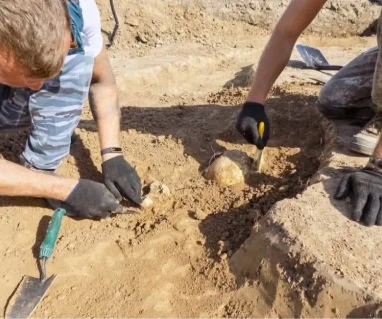
Archaeological Survey
GPR surveys allow archaeologists to map subsurface anomalies and buried objects across large areas, minimizing invasive excavation while producing detailed subsurface images that guide targeted research.
Environmental
The GPR method detects subsurface contamination, maps soil moisture variations, and identifies underground storage tanks and other subsurface features critical to environmental investigations and remediation planning.
Geotechnical
Our GPR systems provide precise radar data for soil and rock characterization, mapping subsurface layers, and assessing geohazards. The ability to detect subsurface anomalies, measure ice thickness, and map freshwater resources makes ground-penetrating radar an essential geophysical method for ground surveys and geotechnical site assessments.
See Us LIVE at CONEXPO 2025
We’ll be exhibiting in Las Vegas from March 3–7.
Come visit us at Booth S60334.
Contact us
Our team of experts can help you select the best GPR system for your specific needs. Contact us to speak with a real person about your upcoming projects.

Join Thousands of Satisfied Field Experts With a US Radar System.
Frequently Asked Questions About GPR Ground-Penetrating Radar
How does ground-penetrating radar work?
A GPR system sends short radar pulses of electromagnetic energy (also called radio energy) into the ground and listens for reflections. When each electromagnetic pulse hits a boundary where material properties change (such as the edge of a buried pipe), part of the radar signal bounces back to the receiving antenna. The system records the strength and travel time of every return, then builds a real-time GPR profile that shows what’s below the ground surface so operators can interpret findings on site.
Ground-penetrating radar theory is based on the same principles as other electromagnetic methods: transmit EM waves into a medium, then analyze the reflected signal to map subsurface conditions. The US EPA describes GPR as a popular geophysical technique due to its rapid collection speed and high spatial resolution, and ASTM D6432 notes that GPR commonly uses high-frequency EM waves ranging from 10 to 7,000 MHz. US Radar systems simplify the entire process with auto-calibration that adjusts to surrounding soil conditions automatically, so operators can power on and start scanning in minutes.
What affects GPR depth and the effective depth range?
Two factors matter most: antenna frequency and ground conditions. Lower frequency antennas reach greater depths (greater subsurface penetration), while higher frequency antennas provide finer detail closer to the surface. The effective depth range also depends on how easily radar waves pass through the soil, which is determined by the ground’s dielectric properties (specifically dielectric permittivity, also called relative permittivity or the dielectric constant).
In dry sand, gravel, or rock, GPR achieves excellent depth. In wet clay soils with high electrical conductivity, subsurface penetration is more limited, and systems are generally restricted to detecting near-surface disturbances. High-conductivity materials absorb more signal energy, reducing how far radar waves can travel. US Radar’s triple-frequency technology addresses this trade-off by simultaneously emitting three signals across the low, mid, and high frequency ranges, delivering greater penetration depth and fine resolution from a single pass without requiring operators to select a single compromise frequency.
Can GPR identify what a buried object is made of?
GPR shows the presence, depth, and approximate shape of subsurface features, but it cannot directly identify the composition of a target. The system detects contrasts in the electromagnetic and electrical properties of materials below the surface. What varies is the strength of the GPR signal reflection at each boundary, depending on differences in relative dielectric permittivity between the target and the surrounding soil. Two different materials can produce similar reflections if their dielectric properties contrast with the ground in a similar way.
This is where US Radar’s triple-frequency technology adds value. By cross-comparing three independent datasets, operators can evaluate targets from multiple frequency perspectives, improving confidence in data interpretation. Combined with field context (target shape, depth, orientation, and known site conditions), experienced operators can make well-informed assessments about what each reflection likely represents.
Does GPR work in all soil types and ground conditions?
GPR works across a wide range of soil conditions, with performance varying by site. The technology performs best in materials with low electrical conductivity (dry sand, gravel, rock) where radar waves travel farther with less signal attenuation. Performance is more limited in high-conductivity materials such as saturated clay or mineral-rich soils, where electromagnetic energy is absorbed more rapidly.
The relative dielectric permittivity (dielectric constant) of ground surface materials directly affects both subsurface penetration and depth accuracy. Moisture changes across a site can affect how fast radar waves travel, which is why consistent calibration is important. US Radar systems handle this automatically, auto-calibrating to local soil conditions before each scan and accounting for variations in dielectric properties without requiring operators to manually calculate soil parameters. You simply power on, calibrate, and start collecting data.
What standards and regulations apply to GPR investigations?
GPR is supported by well-established engineering geophysical standards that provide professionals with a clear framework for investigations. ASTM D6432-19 is the primary standard guide, covering equipment selection, field procedures, and data interpretation for surface GPR work. Additional ASTM standards apply to specific uses, such as pavement thickness measurement and bridge deck evaluation.
For utility locating, ASCE 38-22 defines quality levels for subsurface utility engineering (SUE) data. The Common Ground Alliance (CGA) Best Practices guide uses these quality levels to distinguish between QL-B (surface geophysical techniques, including GPR for approximate positioning) and QL-A (physical exposure through soft digging for precise confirmation). US Radar systems are designed to support these standards, delivering the data quality professionals need for compliant, defensible investigations.
Why is GPR preferred over other subsurface investigation methods?
GPR detects both metallic and non-metallic targets, which sets it apart from electromagnetic locators, which respond only to metallic conductors. This means GPR can find PVC pipes, fiber-optic lines, and other non-conductive utilities that other geophysical techniques and electromagnetic methods miss entirely, because it relies on contrasts in dielectric properties rather than on conductivity alone.
GPR is also non-destructive and covers ground quickly. The CGA’s 2024 DIRT report analyzed nearly 197,000 unique damage reports, with locator error accounting for approximately 12% of the leading root causes. Accurate subsurface imaging helps reduce these risks by providing a detailed GPR profile before excavation begins. Penetrating radar theory applies across disciplines from utility locating to infrastructure assessment and environmental studies, making it one of the most versatile geophysical methods available.