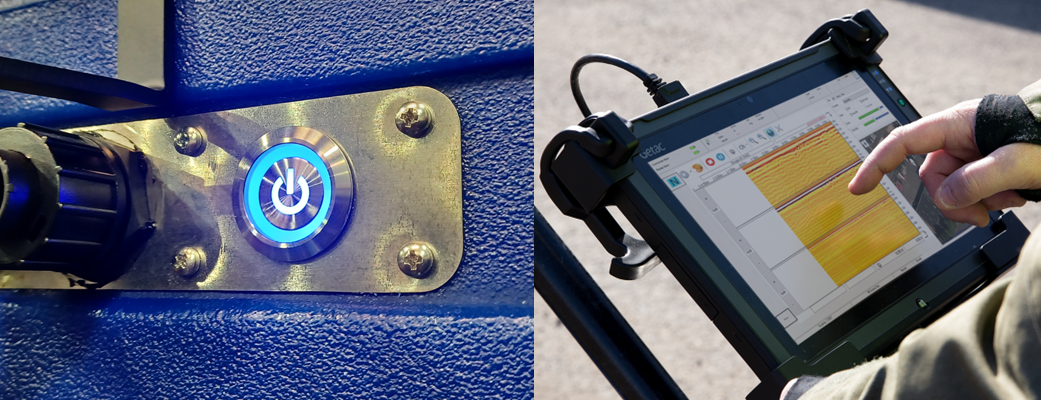
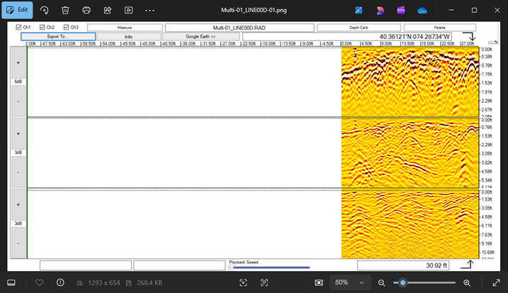
Acquisition Software drives every US Radar system. Users can easily navigate the crisp display and user-friendly interface to find and identify targets of all material compositions.
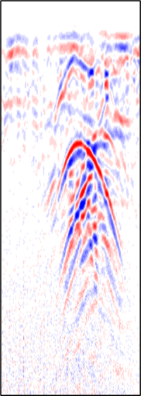
Beyond locating targets, Acquisition software can also help you fine-tune your data for more visibility. Users can choose a variety of vibrant color palettes and elect to automatically apply gain as required. This data can be displayed in real-time as well as saved and post-processed for future use.
What GPR Systems Use This
Software?
Acquisition Software is included with every US Radar system. The software is installed and ready to go with every purchase. Depending on your specific needs, you can also incorporate a variety of optional upgrades later on.
Is Acquisition Software Difficult to Learn?
Our Acquisition Software is specifically designed to be easy to learn. With some brief, low-intensity training, anyone on the jobsite can learn how to use it to generate valuable results within a day.
Acquisition Software
Features
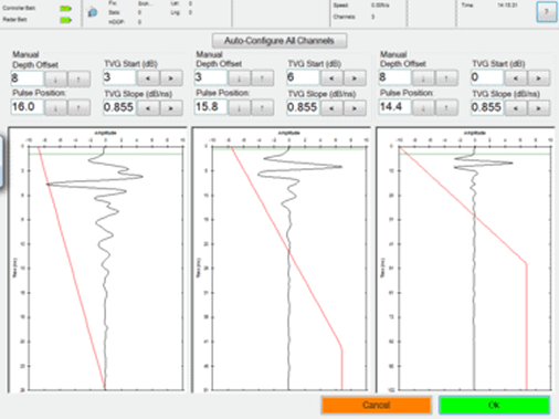
Auto-Calibration
Time-Varying Gain
User-Defined Algorithms
Backtrack Feature
Position Readout
Snapshot
Record
Measure Tool
Tagging/Annotation
Auto Configuration
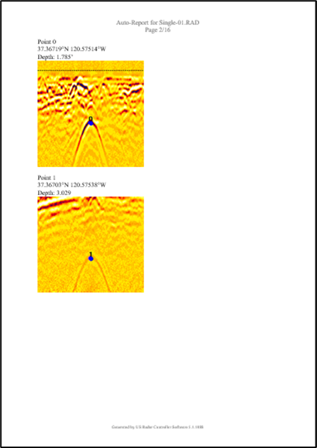
Auto-Report
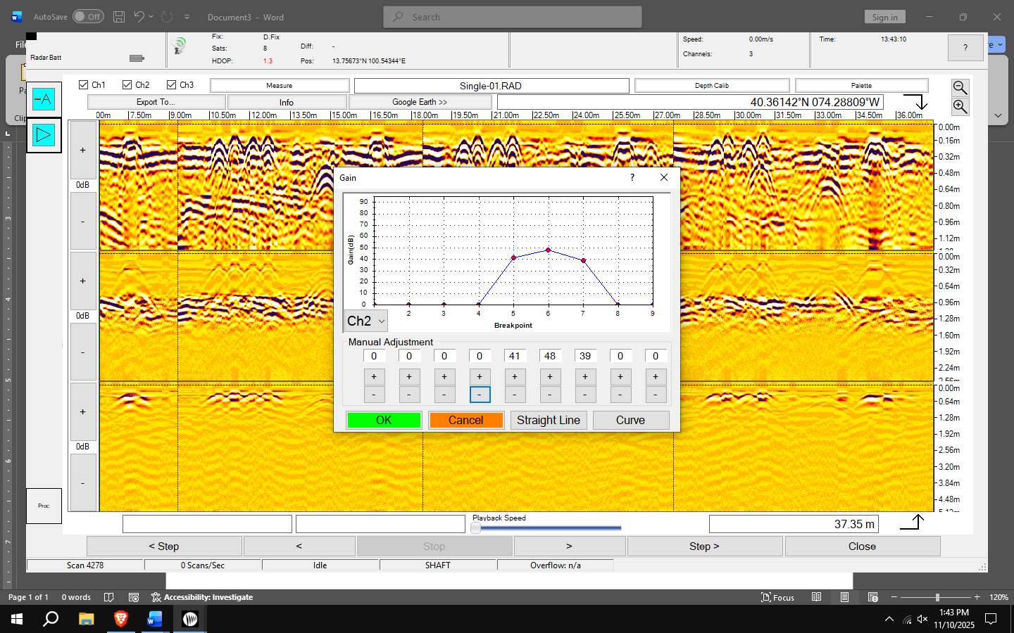
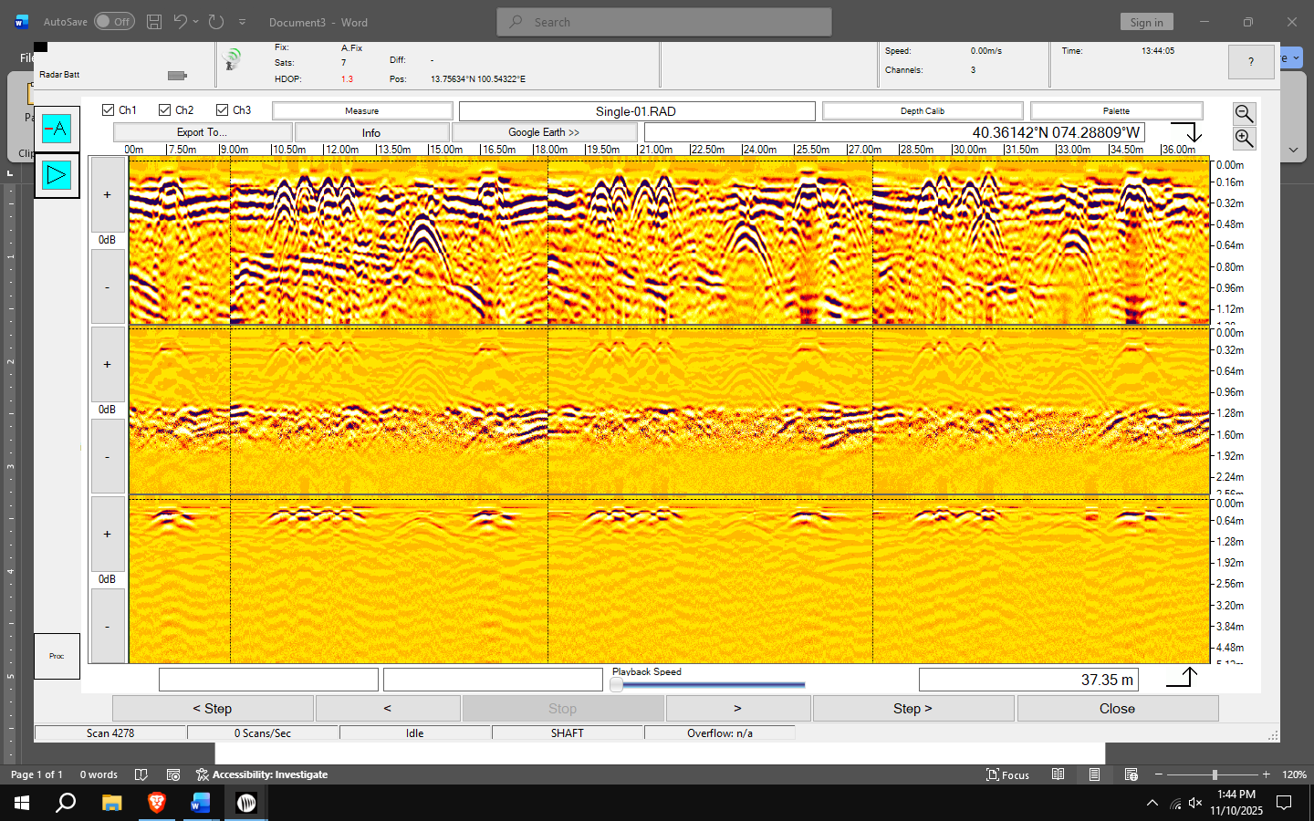
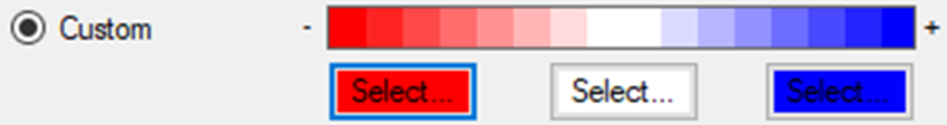
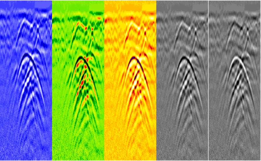
Color Palette
Screenshot/Slice Image
Auto-Calibration
Time-Varying Gain
User-Defined Algorithms
Backtrack Feature
Position Readout
Snapshot
Record
Measure Tool
Tagging/Annotation
Auto Configuration
Auto-Report
Color Palette
Screenshot/Slice Image
Auto-Calibration
Using a unique averaging removal algorithm, the antenna and software recognize prevailing soil conditions and calibrate the images for optimum data collection.
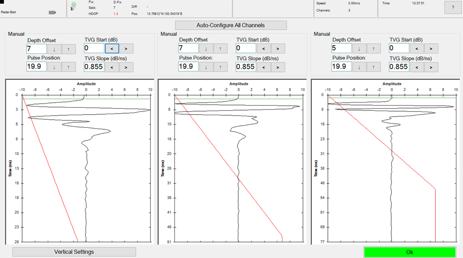
Time-Varying Gain
Only available on US Radar software! Raises the gain profile based on depth level using user-defined points.
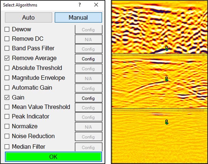
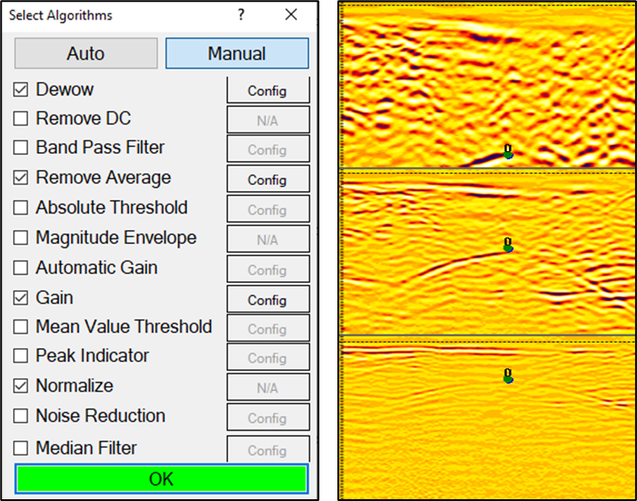
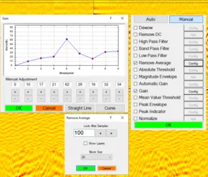
User-Defined Algorithms
Set, change, and adjust data appearance using onboard algorithms.
Backtrack Feature
Line up points for easy field marking. Move the radar backwards to line up with potential subsurface targets.
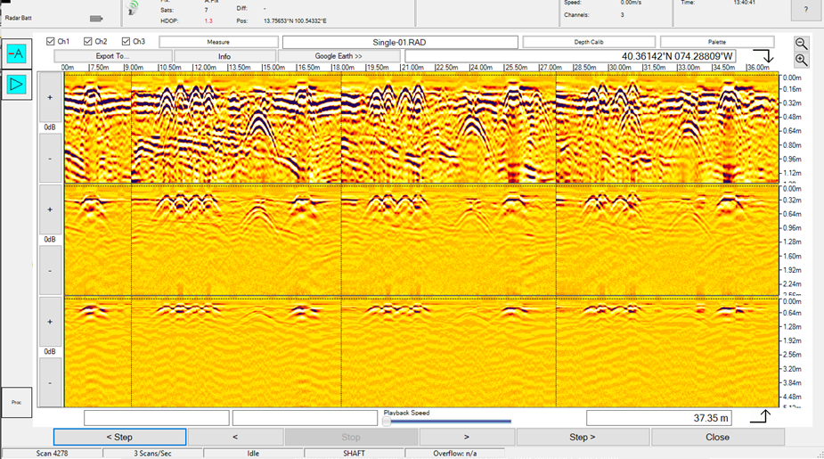
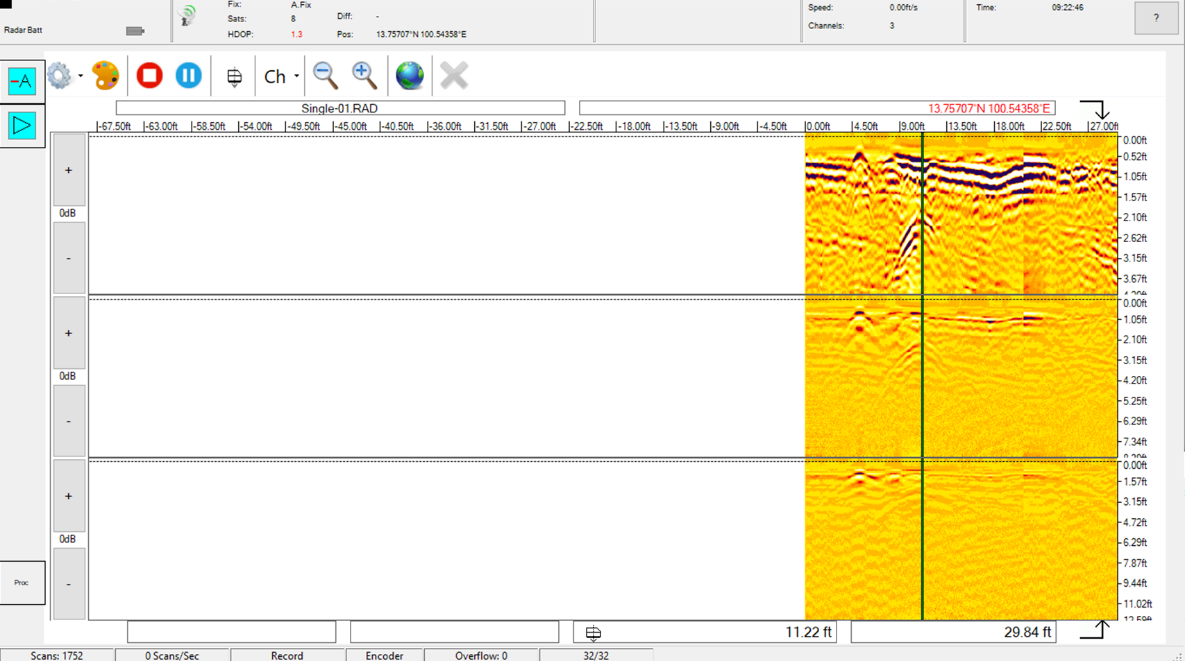
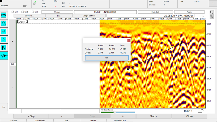
Position Readout
Simply tap the screen on an image of interest and the distance from the beginning of your pass and the depth will be displayed (X and Z coordinates). This feature works both in real time and when replaying data.
Snapshot
Store full-screen images for reports, sharing with others, and printing. One tap of the touch screen “Snapshot” function and the image is saved.
Record
Full scans are stored for later analysis and review.
Measure Tool
Measure the distance and difference in depth between any two points.
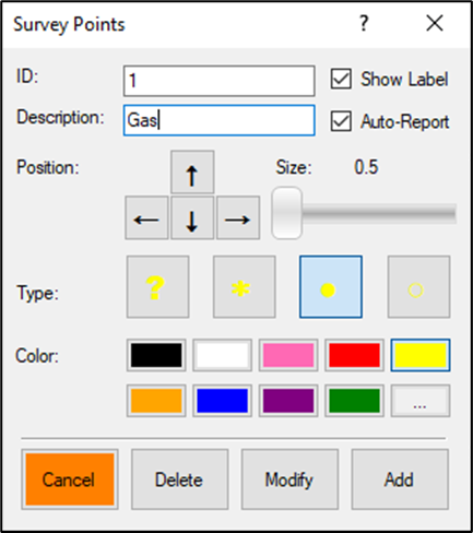
Tagging/Annotation
With a simple double tap on the screen, points can be added to highlight areas of interest. Points can be easily edited during later processing.
Auto Configuration
Using real-time interaction between the radar waves and the subsurface this feature automatically adjusts settings to compensate for soil composition and condition.
Auto-Report
Creates report deliverable using user defined data points. Uses universal .RTF text files that can up opened and edited using any word processing software.
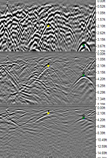
Color Palette
Change the appearance of data for easier viewing. Preset colors are Yellow, Blue, Green/Red, Gray Scale, and Inverse Gray Scale. User created Custom Palette is also available.
Screenshot/Slice Image
Save a screen shot or the entire data slice image. Can easily be sent via email.
Advanced Acquisition Software Features
Advanced Depth Calibration
The depth scale can be calibrated based on targets at known depths.
Advanced Dielectric
Constant Entry
The operator can enter their own values for dielectric constant.
Advanced Attenuation
Entry
The operator may enter their own values for attenuation in dB/m.
Signal Loss Calculation
When entering dielectric constant and attenuation, the signal loss is calculated automatically.
Advanced Algorithms
Operator may enter advanced filtering algorithms, such as low pass and high pass FIR filters, remove DC, peak envelope, and more.
Have Questions About Our Acquisition
Software?
Do you want to ask one of our team members about our software? Contact us today and speak with a GPR system expert to have your questions answered.