

In 2020, researchers at Clemson University were busy figuring out who might have been buried in more than 600 unmarked graves. The graves were found in the on-campus Woodland Cemetery during a survey using ground-penetrating radar.
Those unmarked graves were discovered 100 years after the area became the official cemetery for Clemson presidents, faculty and other individuals. And they’re equal in number to the known grave sites that were dug after 1920.
So how did Woodland Cemetery not know about that many burial sites? For the same reasons many cemeteries are missing information about their own properties — and why cemetery maps are often inaccurate or incomplete. Find out more about common cemetery mapping challenges below and how GPR can help.
7 Challenges That Lead to Inaccurate Cemetery Maps
Accurate cemetery maps are important for many reasons. They help loved ones and descendants know where family members are buried, ensure cemetery management understands what burial plots are available and allow construction and building to occur while appropriately honoring final resting places. Solving common challenges in creating accurate cemetery maps and records is, therefore, important. Here are seven of the most common reasons grave maps and records may not be accurate or complete.
Previously Poor Record Keeping
Modern cemeteries typically keep detailed and accurate records of burials. They record what section, lot/row and space a person is buried in, along with information, such as full name, date of birth and perhaps next of kin. This information is stored digitally — usually with cloud-based backups, so it’s very hard for the data to be completely lost.
That wasn’t always the case. In the past, cemeteries might have been managed by towns, churches, groups of like-minded people or even individual property owners. Records were kept on paper — if at all.
Properties with burials that date back many decades or a century or more may have grave locations that were never properly recorded.
Loss or Degradation of Historical Records
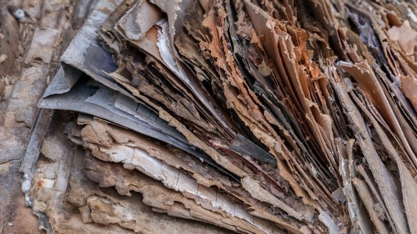
Even when historical cemetery or church staff kept fastidious records about grave sites, that information may not be available today. Fire and flood could have destroyed records, or the old paperwork might simply have become so degraded it’s illegible.
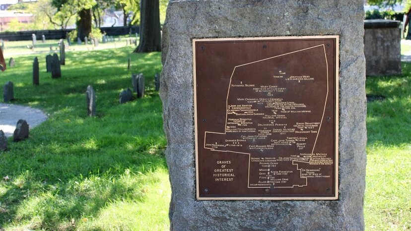
Inconsistent Artistic or Cartographic Renderings
Over the years, many cemeteries have invested in maps to assist management teams or to provide to visitors and family members. Sometimes these maps are simply artistic renderings of the layout, which means they aren’t accurate as far as scale or location is concerned and may not even include all structures and grave areas. Older cartographic renderings may be more accurate but would only capture the structures and grave locations obvious in an above-ground visual survey.
Different Organizations Across Cemetery Sections
If all cemeteries were organized in columns and rows of graves, it would be easier to create accurate maps — you might even be able to do so in Excel once you gather the information for every visible grave site.
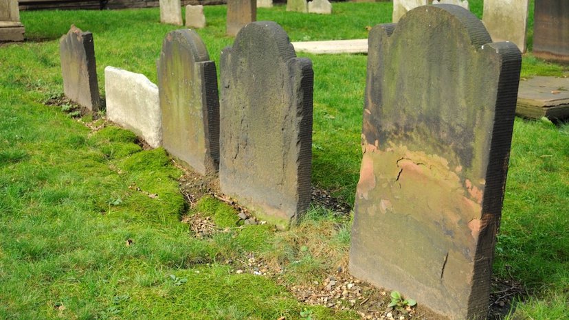
But many cemeteries have inconsistent organization. Most have burial structures that evolved over time, with older grave areas having more random placement than newer ones. In some cases, different areas in the cemetery are dedicated to specific religions and cultures. Each may have its own traditions on how burials are handled and how grave locations are structured. This inconsistency within the same cemetery can make it harder to map.
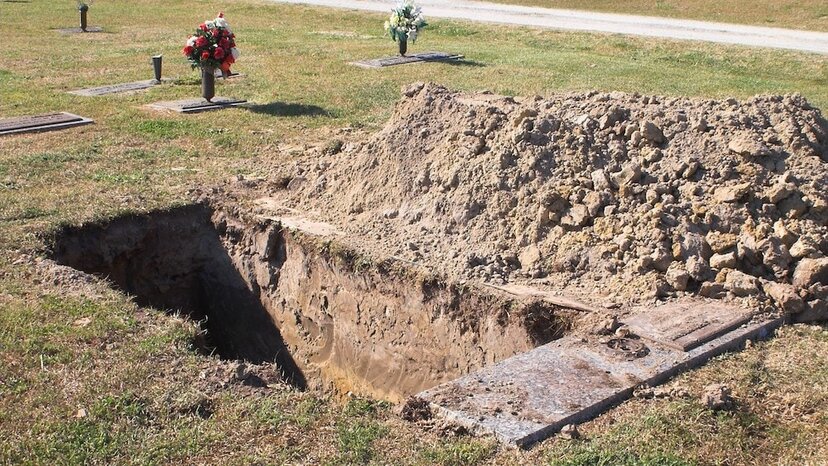
The Potential for Unmarked Graves and Other Structures
The grave sites found in the Clemson University cemetery were never marked — and possibly never recorded — to begin with. Unmarked or unknown grave sites may indicate the burial of unknown or unidentified bodies, enslaved peoples or indentured servants or indigent individuals who didn’t have money to pay for a burial. Historically, it was common practice not to provide markers for such grave sites.
Budgets, Reducing Time or Resources for Mapping
Cemetery budgets and other resource constraints can keep staff from properly mapping a cemetery. Digging into historical records and identifying the location and data associated with every burial site can be time-consuming and labor-intensive — especially without the right technology.
The Knowledge of Cemetery Staff About What’s Below the Surface
In some cases, cemetery staff have no idea what’s below the surface of the landscape. If a radar survey has never occurred, then cemetery staff only know about what they can see above ground or what they might run into by accident when digging to create new burial sites.
This lack of knowledge — which is in no way the fault of the modern staff — might even falsely limit the known “in use” area of the cemetery. Staff might believe, for example, that only the west side of the cemetery contains graves and the east side can be divided and sold as new burial plots. Meanwhile, the east side might be dotted with unmarked and unseen graves, much like the hills of Woodland Cemetery on the Clemson campus.
How Can GPR Help?

GPR can help solve many of the common challenges in creating accurate cemetery maps. It provides a fast, cost-effective way to discover what’s under the ground, ensuring cemeteries know whether there are unknown or unmarked graves. GPR surveys also plot the horizontal location of items, providing detailed data that can be fed to computer models to create highly accurate cemetery maps.
Can GPR Detect Graves?
Yes, ground-penetrating radar can detect graves. Some specific ways it can do so include:
- Identifying the shape of items buried under the ground. If you’re surveying a cemetery location and see rectangular shapes the size of a coffin or casket, you can typically assume those are burial locations.
- Detecting wood, metal and other various materials. GPR can detect most of the types of materials caskets and coffins are made of currently, as well as historic materials.
- Locating shifts and voids in the soil. GPR can detect where a void occurs in the soil, which can indicate something buried underground. In some cases, it can detect that the soil in a certain area was shifted or disturbed, indicating a grave was dug.
Can GPR Detect Bodies?

Yes, in some cases, GPR can detect bodies. For example, it can detect bones if the body was recently buried (within the past few decades). It can also detect areas where a human body may have been buried by looking for locations where the soil was moved in an unnatural way. Trained professionals using GPR can detect these locations many years after the burial actually occurred.
How Accurate Is GPR at Finding Graves?
GPR is one of the most accurate technologies for finding graves. You can use it for this purpose in up to many feet of depth in most soil, although accuracy depends on soil conditions. In optimal conditions, GPR can detect something that measures ¼” or 6 millimeters at a depth of up to 15 feet/4.5 meters.
Discover How GPR Can Solve Your Cemetery Mapping Challenges

Talk with a US Radar representative about your cemetery mapping challenges and how our GPR solutions can help. Contact us today for more information, including what GPR products might be right for your needs.
FAQs About Cemetery Maps and GPR
What is grave mapping?
Grave mapping is the act of discovering all grave sites on a property and creating an accurate visual representation of their location. In many cases, ground-penetrating radar is used to capture comprehensive data about all graves that might be below the surface.
What can GPR detect?
GPR can detect pipes and utilities, concrete structures, wood, voids in soil, cracks and corrosion, caves, potential mineral deposits, tombs and graves and past unnatural movement of the soil.
How does a GPR survey work?
GPR devices are rolled over the ground, typically in a grid or line pattern, to ensure comprehensive coverage. As the device is moved over the ground, it transmits signals into the ground and “listens” for how those signals interact with elements underground. The signals “bounce” off of various elements differently, and the GPR device can convert that data into readings about what might lay below. Those readings can often be converted to visuals that help trained surveyors understand what’s under the surface.


