
3D Imaging and Modeling for Ground-Penetrating Radar
Bring Data to Life and Create a Visual Model of What You’ve Found
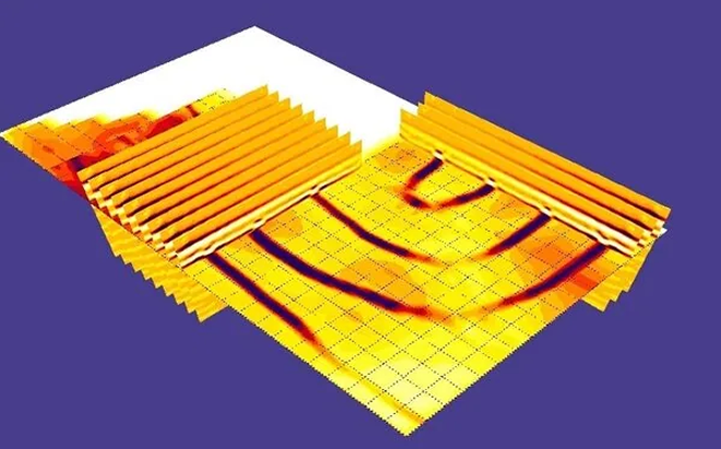
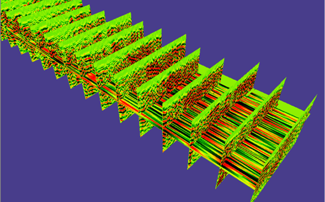
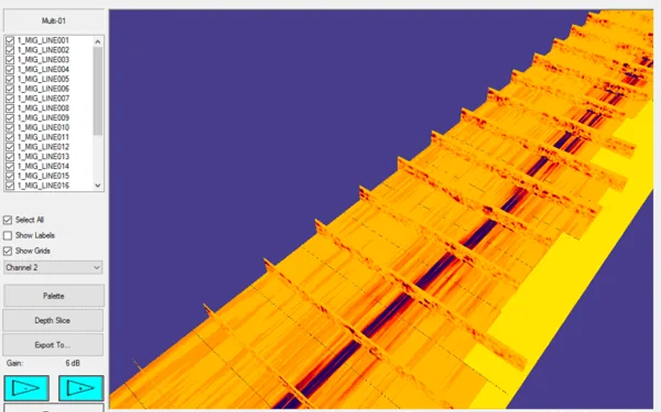
Raw GPR data provides valuable insight to users and stakeholders alike. However, when really looking to drive the point home, one may want to consider rendering GPR data in 3D to provide even greater context.
Like with anything related to GPR data, 3D imaging does not image the exact outline of an object, but it can help illustrate the general length, width, and trajectory of a target or anomaly. When sharing data with others, this will allow them to easily see and comprehend your findings as you explain them.
Viewing your GPR scans in 3D allows you to see them more clearly. With our 3D imaging software, you get the power to:
- Generate multi-scan slice overlays
- Rotate and zoom data slices for analysis
- Generate depth slices and peak maps
- Drop paths onto map with GPS integration (optional)
- Versatile migration and real-time processing
- Versatile migration and real-time processing
- Time/depth slices of user-definable areas and shapes
- Adjustable transparency
- Adjustable clip plane options
- Turn individual scans and slices on and off
- Preview generated images before adding them to 3D model
- Data can be exported to other viewing software, such as Voxler, to generate isosurface renderings
- Data can also be exported in laser scanner/point cloud format
Learn More About Our 3D Imaging GPR Software
Do you think this software will enhance the way you present your subsurface imaging data? If so, our team would love to help connect you with the best software solutions for your needs anytime.