
Other GPR Uses
Ground-penetrating radar technology extends far beyond traditional applications, serving professionals across industries who need to see beneath the surface without invasive excavation. Whether detecting subsurface anomalies in environmental studies or mapping ice sheets in geophysical research, GPR systems provide accurate subsurface imaging data when other methods fall short.
Why Choose US Radar for Other GPR Uses?
US Radar has pioneered ground-penetrating radar technology since 1994, developing systems informed by real-world experience across countless applications. Our triple-frequency range GPR systems deliver clearer subsurface imaging than single- or dual-frequency alternatives. With the ability to detect targets from shallow depths to 30+ feet, our equipment addresses detection challenges that extend beyond conventional GPR applications.
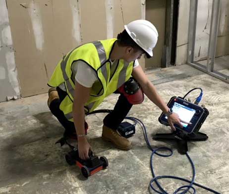
Our ground-penetrating radar equipment is designed for immediate use—simply power on, auto-calibrate to soil conditions, and start scanning. You can operate our systems confidently from day one, collecting data and identifying burial locations without specialized expertise or complex setup procedures.
Our Ground-Penetrating Radar Products
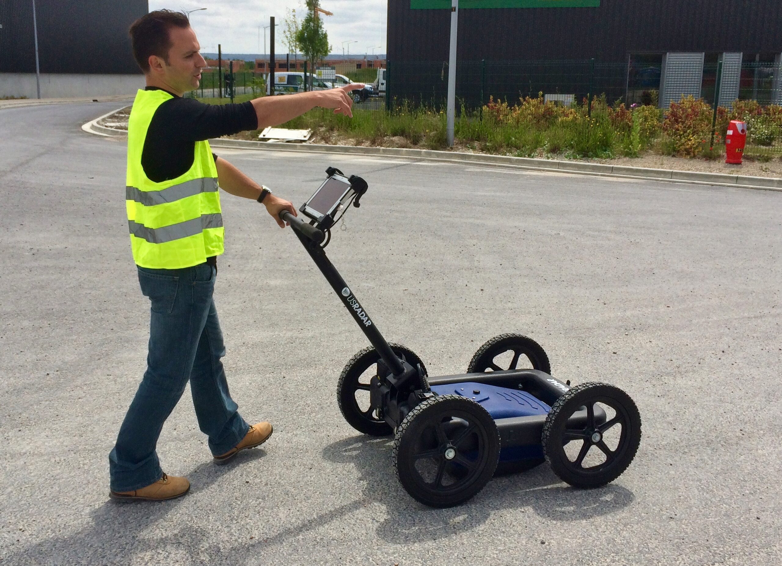
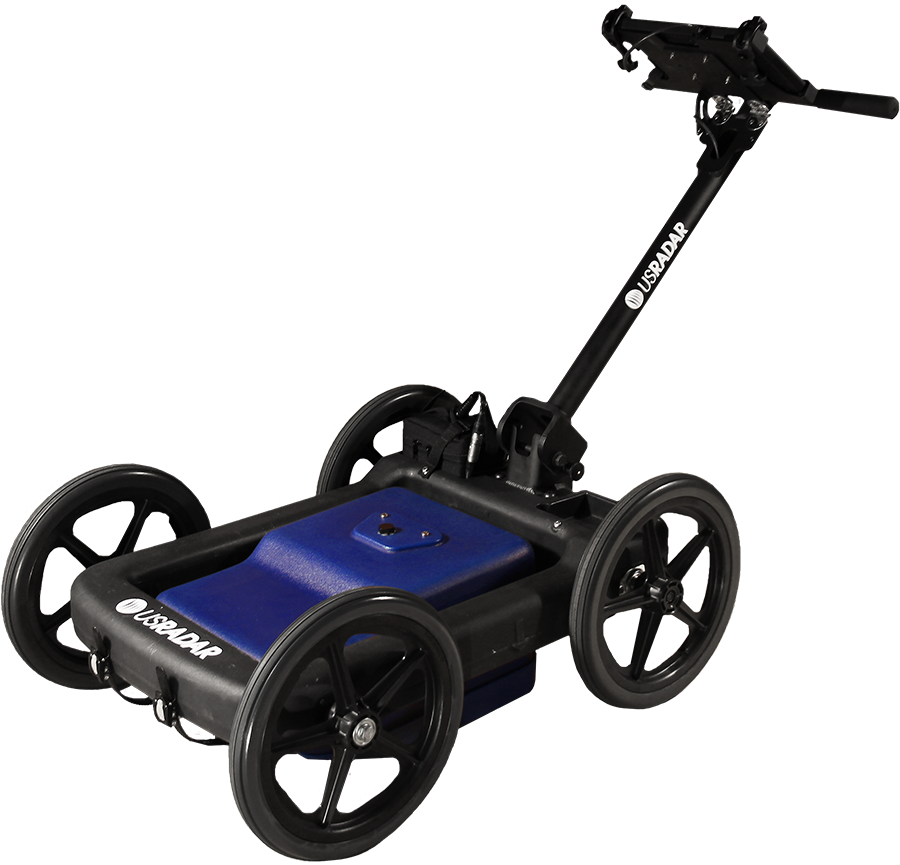
GPRover Utility Mapping System
The GPRover utility mapping system combines triple-bandwidth ground-penetrating radar theory with precision GPS connectivity to create subsurface maps in real time. Perfect for detecting unmarked graves, mapping burial sites, or locating buried utilities in complex environments, the system requires no base station and delivers accuracy within 2 inches out of the box. Patented slope-correction technology automatically compensates for uneven terrain, making it practically all-terrain across diverse field conditions.
Highlights:
- GPS-integrated mapping with 2-inch accuracy
- Triple frequency for varying subsurface materials
- Patented slope correction for all-terrain use
Quantum Imager Triple Frequency GPR System
The Quantum Imager is the first true triple-frequency range ground-penetrating radar system ever produced. The antenna emits three separate signals simultaneously across low, mid, and high frequencies—generating three independent datasets for cross-comparison and superior confidence when detecting subsurface anomalies. Stepped ultra-wideband pulses combine the advantages of pulse radar and stepped-frequency radar, delivering unsurpassed resolution and penetration depth.
Highlights:
- First triple-frequency GPR system ever produced
- Stepped ultra-wideband for superior resolution
- Clear data interpretation across diverse applications
Q Series GPR Systems
Our Q Series provides versatile ground-penetrating radar solutions across different frequency ranges to match specific detection needs. The Q5 serves budget-conscious applications requiring basic subsurface object detection. The Q10 delivers high-frequency imaging for shallow investigations where resolution matters more than depth. The Q25 operates at 250 MHz for moderate depth applications with clear imaging of subsurface features.
These systems offer reliable detection capabilities for specialized applications where dedicated frequency ranges optimize results. From ice thickness measurements to shallow soil layer mapping, the Q Series provides clear GPR signals and straightforward data collection for professionals who need proven technology without unnecessary complexity.
Highlights:
- Multiple frequency options for targeted applications
- Clear imaging across varying depths
- Reliable detection in diverse conditions
100 Series Geophysical Scanner
The 100 Series delivers deep penetrating radar capabilities for geophysical research and applications requiring maximum depth. Capable of reaching depths up to 100 feet, this system excels at mapping deep geologic structures, detecting voids in subsurface formations, and investigating features where lower frequencies penetrate deeper than high-frequency alternatives.
Ideal for environmental studies requiring deep subsurface investigation or geophysical methods to examine large-scale features, the 100 Series provides the depth penetration needed when surface- or shallow-level detection methods prove insufficient. The system delivers clear return signals even from deep subsurface objects.
Highlights:
- Deep penetration up to 100 feet
- Ideal for large-scale geophysical applications
- Clear return signals from deep targets
Common Ground-Penetrating Radar Challenges
Challenge | What It Looks Like | How We Help |
|---|---|---|
Detecting Objects in High Electrical Conductivity Soils | Clay-heavy or wet subsurface materials rapidly attenuate radar signals, limiting penetration depth and reducing the clarity of reflected signals from buried objects. | While wet clay soils generally limit GPR to detecting near-surface disturbances, our triple-frequency systems maximize detection within these constraints. Lower frequencies penetrate as deeply as soil conditions allow, while higher frequencies maintain resolution for shallow targets. |
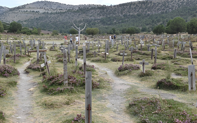
Mapping Subsurface Features Without Disturbing Sites | Archaeological sites, burial sites, or contaminated areas require detection without excavation that would damage evidence or spread contamination plumes through disturbed soil. | GPR is a non-invasive method that uses electromagnetic energy to image subsurface structures without drilling, digging, or disturbing the ground surface. |
Interpreting Complex GPR Data | Multiple soil layers, varying dielectric properties, and different velocities across materials create complex radar data that require experience to interpret accurately and identify actual targets. | Our direct RF sampling technology produces clearer images than older systems, while our training programs ensure operators understand data interpretation techniques to support confident target identification. |
Achieving Adequate Depth in Variable Conditions | Fresh water, ice thickness measurements, and deep void detection require systems that penetrate deeper than standard utility locating equipment while maintaining usable signal strength. | Our 100 Series reaches depths up to 100 feet for deep geophysical applications, while Quantum Imager and GPRover deliver 30+ foot depth with superior resolution across frequency ranges. |
Creating Permanent Subsurface Records | Temporary paint markouts disappear, and unmarked graves or buried utilities need permanent documentation that multiple stakeholders can reference and update over time for ongoing projects. | Our GPS integration creates digital subsurface maps with precise coordinates that can be exported to CAD, GIS, or Google Earth formats for permanent, shareable records. |
Detecting Small Targets at Depth | Post tension cables, small voids, or buried evidence may be too small for lower frequency systems to resolve clearly, even when penetration depth is adequate. | Triple frequency technology provides high-frequency resolution for small target detection while simultaneously collecting mid and low frequency data for depth penetration and cross-comparison. |
Frequently Asked Questions
How much does ground-penetrating radar equipment cost for specialized applications?
GPR system costs vary based on frequency requirements, depth capabilities, and features needed for your specific application. Our Q Series starts at entry-level pricing for basic detection, while triple frequency systems like the Quantum Imager and GPRover represent investments in superior depth and resolution. Contact us for detailed pricing based on your detection requirements—we provide transparent quotes that reflect the technology and capabilities you actually need.
What makes US Radar different from other ground-penetrating radar manufacturers?
We introduced the first true triple frequency range GPR system in 2014, and we remain the only manufacturer offering three separate signals simultaneously for independent dataset comparison. Our systems are designed and built in the USA with 30+ years of field experience informing every product decision. What truly sets us apart is ease of use—our systems feature automatic calibration and real-time displays that allow anyone to operate them confidently, identify grave locations, and document burial sites without specialized expertise.
Is high-frequency or low-frequency GPR better for my application?
High frequencies provide superior resolution for shallow targets and small objects but offer limited penetration depth. Lower frequencies penetrate deeper through subsurface materials but sacrifice resolution. Our triple-frequency systems eliminate this trade-off by emitting across all frequency ranges simultaneously—you get high-frequency resolution, mid-range utility detection capabilities, and low-frequency depth in every scan without changing equipment or making multiple passes.
How quickly can I start collecting data with US Radar systems?
You can start scanning and collecting subsurface data immediately. Our auto-calibration technology eliminates complex setup procedures—simply power on, let the system calibrate to soil conditions, and begin scanning. Our Acquisition Software displays real-time subsurface imaging as you collect data, so you’re seeing results from your first scan. The intuitive interface lets you operate confidently from day one without specialized expertise.
How do I know if I need ground-penetrating radar for my project?
If you’re facing detection challenges where drilling would be destructive, excavation is impractical, or other geophysical methods haven’t provided adequate subsurface information, GPR often proves ideal. Projects requiring permanent digital records, GPS-integrated mapping, or detection across varying soil layers benefit significantly from radar-based imaging. For applications involving unmarked graves, burial sites, environmental contamination assessment, or forensic investigations, GPR provides a non-invasive method that preserves site integrity while delivering detailed subsurface data.
Can ground-penetrating radar detect objects in all soil types and conditions?
GPR performance varies based on subsurface materials and their electrical properties. The technology works exceptionally well in sandy soils, dry conditions, fresh water ice, and low-conductivity environments. High electrical conductivity soils, like saturated clay, can limit penetration depth as electromagnetic energy attenuates more rapidly. However, our triple-frequency systems adapt to challenging conditions by automatically adjusting radar signals and providing multiple frequency datasets. For most applications, GPR technology delivers usable subsurface imaging even in less-than-ideal conditions where single-frequency systems fail.
How deep can ground-penetrating radar actually penetrate in real-world conditions?
Penetration depth depends on frequency range, subsurface materials, and their dielectric properties. Our Quantum Imager and GPRover systems typically detect targets up to 30+ feet deep in favorable conditions, while the 100 Series reaches depths up to 100 feet for deep geophysical applications. In highly conductive soils or wet conditions, depth may be reduced. Lower frequencies generally penetrate deeper but offer less resolution, while higher frequencies provide superior target definition at shallow depths. Our triple-frequency technology provides the full spectrum in every scan.
What's the difference between pulse radar and stepped frequency systems?
Pulse radar transmits short electromagnetic pulses and measures reflected signals to create subsurface images, offering fast data collection and simple operation. Stepped frequency radar transmits multiple discrete frequencies sequentially, providing superior resolution but requiring longer scan times. Our Quantum Imager uses stepped ultra-wideband pulses that combine the advantages of both methods—delivering unsurpassed resolution and depth while maintaining practical field operation speeds for efficient data collection.
Can GPR data be exported to other software platforms for advanced analysis?
Yes. Our systems provide comprehensive export capabilities, including CAD files, Google Earth files, and formats compatible with various third-party geophysical software packages. This allows you to integrate GPR data with existing GIS workflows, structural analysis programs, or specialized data interpretation tools. Our GPS integration module ensures subsurface features are georeferenced accurately for seamless integration with mapping platforms and collaborative project environments where multiple stakeholders need access to subsurface information.
Does GPR Sound Like the Right System for You?
Do you think GR will help you on your job site? If so, our team would love to help you determine the best system for your specific needs. Contact us today to speak with one of our team members.