

Ground-penetrating radar, commonly referred to as GPR, is a type of subsurface imaging that’s used to detect underground objects or voids. Because the technology is noninvasive and cost efficient, GPR has become a go-to tool with applications in a wide array of industries. However, to assess the potential benefits of ground-penetrating radar, it’s helpful to understand more about how this technology works. Continue reading and visit our site to learn more about GPR and its benefits.
The Science of Ground-Penetrating Radar

Ground-penetrating radar creates comprehensive subsurface images by transmitting electromagnetic energy into soil, concrete or other ground material to detect objects, voids and anomalies. The GPR unit sends out pulses of waves in the microwave band, with frequencies typically ranging between 1 and 1000 MHz. These pulses penetrate into the earth and are reflected, refracted or scattered when they encounter a change in material, indicating an object or another type of anomaly.
The strength of this reflection, known as its amplitude, depends on the contrast in conductivities between the materials the signal passes through, and how the impulse reacts is primarily determined by the object’s density and size. This altered signal is then picked up by the GPR unit’s receiver, where it’s recorded along with its two-way travel time. The amplitude, travel time and relative permittivity of the subsurface materials are combined to create a depth scale for the scan.
Using specialized GPR software, the raw data is then translated in real time into imagery to provide an accurate map of subsurface elements. Trained technicians can interpret these images, which often appear as black and white static, with anomalies represented as hyperbolas.
The Benefits of Using Ground-Penetrating Radar for Subsurface Imaging
Ground-penetrating radar has become the technology of choice for industries that need to know more about what lies in the ground. GPR is cost-effective enough for regular use, and because the technology is noninvasive and safe to use, it’s ideal for studies involving public locations, interior spaces or landscaped areas. Its main benefits include its ease of execution, varied detection capabilities and wide array of applications.
Ease of Execution
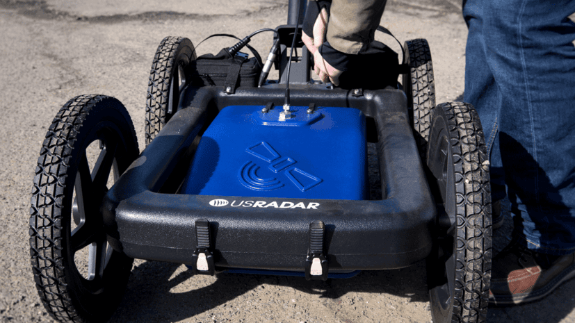
One of GPR’s main advantages is its ease of execution. With a single piece of equipment and a trained operator, GPR can be used to image a large area in a small amount of time.
To begin the imaging, the GPR operator passes the unit over the target location, following consecutive survey lines. As the device moves across the area, an onboard transmitter sends pulses of electromagnetic energy into the ground. If the impulse encounters an object or anomaly, the signal is reflected, refracted and scattered, depending on the object’s density. The unit’s receiver registers and records the returning signal.
Using a series of consecutive scans, the GPR operator can obtain comprehensive data from the targeted area. Onboard software then translates this data into a digital image, providing a map of subsurface structures, voids and other anomalies. Because the actual imaging typically looks like either black and white static or colorful bands, with anomalies represented by hyperbolas, data must be interpreted by trained GPR technicians before it’s usable. However, this can easily be done in real time, letting parties flag areas of interest or concern immediately.
Plus, because GPR units are small and often portable, they can easily scan hard-to-reach areas. Some units may be dismantled for shipping to remote locations.
Detection Capabilities
Typically, ground-penetrating radar can identify anomalies, including voids, in soil, rock and concrete. It can locate metal and nonmetal objects, and it may also detect variations in the composition of the ground.
GPR is capable of detecting the following materials:
- Clay
- Concrete
- Metal
- Plastic
- PVC
- Water
- Wood
Ground-penetrating radar can also alert the operator to recent changes in the soil condition caused by digging or the intrusion of foreign material. Plus, because different frequencies may be used when scanning, GPR pulses can penetrate to varying depths and may be adapted to the composition of the ground. GPR may also be used for concrete scanning, and handheld units can scan vertical surfaces or ceilings.
GPR scans can typically provide the depth and thickness of subsurface anomalies. They also have GPS and mapping integration capabilities so they can deliver an accurate visual map of the target area, which includes coordinates that correlate to areas of interest.
Common GPR Applications
As GPR technology advances, it’s becoming the tool of choice in more and more industries, with a wide array of common applications, including:
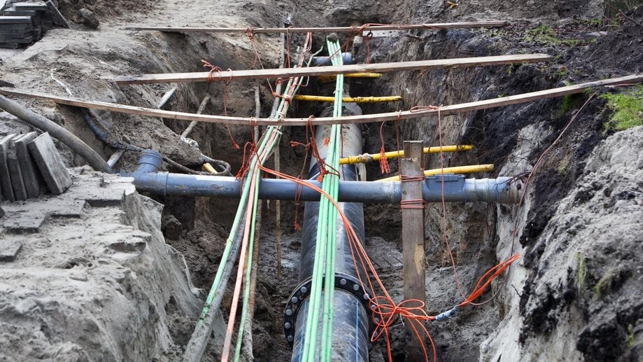
- Utility mapping. Contractors and utility companies often use GPR to locate underground pipes and wires, including older, unmapped infrastructure. Before digging deeper than 18 inches, excavators need to know what lies below the surface so they don’t hit anything important or hazardous. In addition to utilities, GPR can detect abandoned lines, water boxes, septic tanks, missing valves and other unmapped items.
- Law enforcement. GPR can help law enforcement officials locate buried caches of weapons or drugs, as well as underground or hidden structures such as hideouts and tunnels. GPR can be also used to scan vertical surfaces such as walls to help investigators retrieve hidden objects needed as criminal evidence without causing undue damage to either the items or structure. Plus, because GPR can detect disturbed soil, it can lead law enforcement to homicide victims.
- Geophysical surveys. GPR can provide crucial data for geophysical studies, helping scientists and engineers identify bedrock, distinguish strata layers and locate groundwater. GPR can also be used to locate sinkholes and salt-water infiltration and to measure the thickness of ice.
- Cemetery mapping and grave location. Because GPR can identify soil disturbances and find buried objects, it can help researchers locate lost burial grounds and graves. For existing cemeteries, GPR can aid planners in plotting new graves, especially in areas for which no burial records exist.
- Structural assessments. GPR data may also be used to assess structural integrity and damage. Because GPR can locate cracking, voids and concrete spalling, it’s crucial for bridge deck analysis, helping engineers visualize structural deterioration and determine remediation needs.
- Environmental conservation. GPR scans can uncover hidden environmental hazards such as buried drums containing toxic materials. The data may provide insight into the direction of contaminant migration, helping environmentalists remove hazards with minimal damage to nearby flora and fauna.
- Search and rescue. GPR units that send continuous signals into the earth may be used to detect movement, helping rescuers find victims of landslides, avalanches or building collapses. Units with ultrasensitive receivers may be able to detect even slight motions, such as shallow breaths.
- Mining and quarrying. GPR scans detect fractures, faults and joints in rocks, and can alert miners to changes in rock type. Data may be used for mineral exploration and can provide miners with the information they need to design safe, effective tunnels.
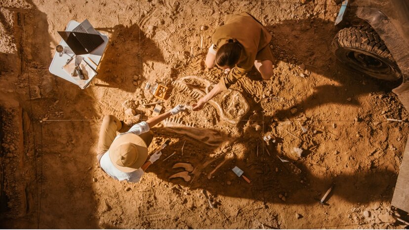
- Archeology. Archeologists often use GPR when investigating current or potential dig sites because it offers them a glimpse into what they’ll find below without destroying the integrity of the area. The data may provide the likely location of graves, structures, human remains or artifacts, and it can help archeologists assess places that may be at risk for potential damage.
The Limitations of GPR
Although ground-penetrating radar can deliver an accurate picture of subsurface objects, it does have several limitations related to:
- Ground composition. When scanning low-conductivity areas, such as those composed of granite or dry sand, GPR may be able to penetrate as deep as 100 feet. However, in places where the ground composition is more conductive, such as areas composed primarily of shale or moist clay, the depth of penetration may decrease to three feet or less due to signal absorption or attenuation. Soil that’s rich in minerals, saline or soluble salts may also return less-accurate results.
- Equipment. The type of antenna used can create limitations, and using the wrong antenna for the job can be severely limiting. For example, although low-frequency GPR antennas, typically ranging between 100 and 200 MHz, offer deeper penetration capabilities, they may return low-resolution images. Higher-frequency antennas, which range from 300 to 1,500 MHz, can pinpoint shallow anomalies with great accuracy but don’t penetrate deep into the earth.
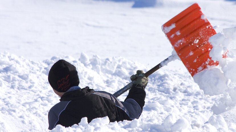
- Weather. Because moisture increases ground conductivity, heavy precipitation, such as snow or rain, may impact GPR scan results.
- Background noise. GPR signals can be affected by background noise created by frequencies used for radio and TV. Scans performed in areas that register high amounts of these types of frequencies may include distortion.
Getting Started With Ground-Penetrating Radar
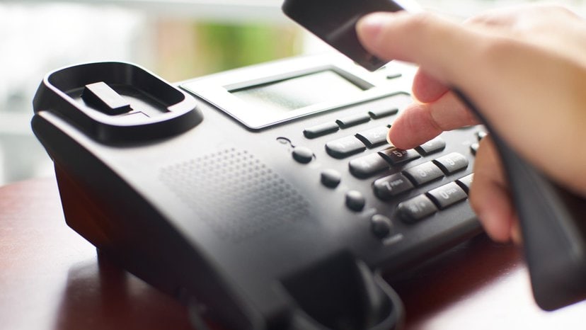
If your job site could benefit from the subsurface data a ground-penetrating radar scan provides, our team can help you assess your needs and determine which system is right for you. Contact us today to learn about available options.


