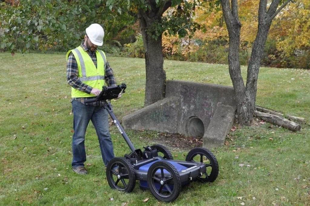
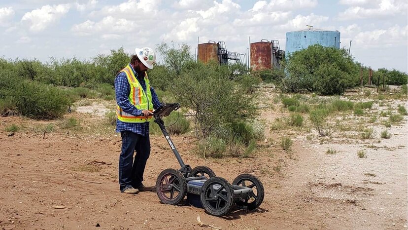
Ground-penetrating radar, or GPR, is a method of surveying subsurface materials. Using electromagnetic radar pulses, GPR can image materials in the ground, concrete, rock, ice and other structures without disturbing the surface. In the last few decades, the technology has come so far that it’s now one of the most common approaches for surveying subsurface materials.
There are a few reasons for this development. GPR offers several benefits over other methods, including cost and accessibility. The biggest benefit, however, is its non-destructive approach. By leveraging electromagnetism, ground-penetrating radar systems enable operators to survey a wide variety of subsurface materials and detect an even wider range of objects within that material without digging a single hole.
But how does GPR work? How can this cost-effective and highly mobile system help professionals locate telecommunication lines or academics search for archaeological artifacts, all without breaking the surface?
The Science of Ground Penetrating Radar
Ground-penetrating radar works by sending a small pulse of electromagnetic energy into the ground and measuring changes and contrasts in the signal when it’s reflected in the receiving antenna. When these pulses enter the material, it produces reflections based on the conduction and dielectric properties of the objects within as well as the surrounding material.
It works like this:
- A transmitting antenna sends a pulse of electromagnetic energy into the ground.
- This pulse passes through the ground and subsurface objects and is then distorted by dielectric and conductive properties.
- The pulse travels back to the receiving antenna and displays the distortions and contrast between objects in the soil and the soil itself.
By analyzing the signal distortions in the signal reflection and examining the contrast between the surrounding ground and objects, operators can infer what’s in the underlying material. It’s worth noting that these methods also detect variations and inconsistencies in the ground material’s composition, such as voids or loose soil.
These waves are capable of traveling through many materials, including various soil substrates, concrete, rock, debris and even water, yet these materials all have different conductive and dielectric properties that impact the reflection of the electromagnetic waves. The strength and amplitude of the reflection are determined by the dielectric and conductive properties of the two materials.
For example, moving from dry sand to wet sand produces a very strong reflection and a sharp contrast in measurement. Moving from dry sand to limestone, on the other hand, will produce far less contrast because the dielectric is quite similar. It’s also worth mentioning that material with higher dielectric properties slows radar waves and prevents them from penetrating as deeply.
When performing a survey with a GPR system, electromagnetic pulses are fired into the ground rapidly — this is what’s referred to as a scan. A GPR scan measures a surface area by moving consistently across the surface and firing continuous pulses of energy into the ground to measure and analyze the aforementioned contrasts and distortions.
Depth and Frequencies
Ground-penetrating radar typically uses signals ranging in the microwave band. In applications that require more accuracy, such as locating conduits in concrete, it uses frequencies toward the higher end. These frequencies don’t penetrate as deeply, but they provide much better resolution.
On the other hand, for applications that require much greater depth, it uses frequencies in the range of 12 MHz to 500 MHz. Depending on the subsurface material, these frequencies can penetrate thousands of feet deep. Depth application is especially useful in surveying areas where there isn’t much certainty as to what’s in the soil.
Many GPR systems come equipped and are designed for only one type of application, so this is an important aspect to consider when looking at solutions. However, some products emit multiple simultaneous frequencies, such as our very own Quantum Imager Triple Frequency GPR System. These solutions offer a unique approach and implementation that combines frequencies to provide an unprecedented level of depth and accuracy.
Understanding GPR Systems

Discussing ground-penetrating radar from these perspectives focuses on the science and technology behind it. And while it seems complicated, using a GPR system and interpreting the data requires only a minimal amount of training and practice. Taking the time to understand how GPR systems work in the real world goes a long way toward becoming proficient with it
Science and technology aside, GPR systems rely on a few different tools to accurately survey subsurface materials. A typical system almost always includes the following:
- Two antennas: one for transmitting and another for receiving
- A computer and display for collecting and analyzing the data
- A power supply for powering everything
When the antennas transmit the electromagnetic waves, the wave distortions are measured and transmitted to the computer and display images and graphs about the subsurface material. With this information, the operator can infer the type of object or objects present as well as their depths.
All of the calculations necessary to display accurate readings happen behind the scenes, using the software. Measuring depth, for example, is a precise calculation determined by the time it takes for a signal to move from the transmitting antenna into the subsurface and reflecting the receiving antenna.
It’s important to mention that this data isn’t passive or only readable in the field. While instant feedback is certainly an aspect of GRP, the data collected by it is sharable and analyzable. With the right GPR software, operators can collect vast amounts of data about the subsurface they’re surveying and share it with colleagues for further processing. Moreover, GPR systems can be coupled with additional technologies, such as GPS or other mapping systems. This can improve large-area scanning and provide a wealth of data to professionals who need it.
While the technology behind GPR is immensely useful, it’s worth taking the time to understand the system as a whole. From the computer to the software running on it, every part of the system comes together to collect, process, display and share data with operators and professionals in meaningful ways.
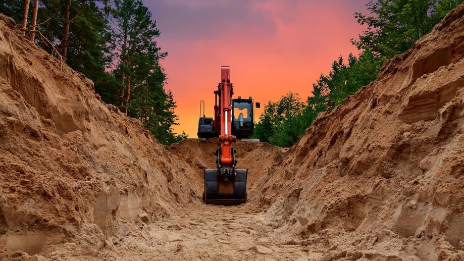
What GPR Can Detect in Subsurfaces
Ground-penetrating radar works best when there’s high contrast in electromagnetic properties between the ground and the objects being surveyed. For this reason, metallic objects are excellent targets, such as rebar in concrete or utilities in the soil.
But, as you can imagine, ground-penetrating radar is extremely effective at detecting a wide variety of materials in subsurfaces. As long as there’s a sufficient difference in the dielectric and conductive properties between the target objects and surrounding material, GPR can detect them. Here are just a few of the more common materials ground-penetrating radar can locate and measure:
- Various metals
- Plastics
- Concrete
- Changes in geological features and ground strata
- Voids and air pockets in the soil
- Various other ground disturbances
For this reason, GPR offers immense versatility across a range of practices and professions. It truly has an endless list of applications.
GPR’s Many Applications and Advantages

Ground-penetrating radar has progressed in leaps and bounds over the last few decades. Once a method seldom utilized in geophysical applications, it has blossomed into a preeminent force across various industries and professions. As such, this now-common geophysical technique has been adopted for myriad applications.
Structural assessment is one of the most common applications for GPR because of the need for non-destructive subsurface surveying. It can help companies accurately assess any issues, such as degradation of concrete, and help identify the location for remediation.
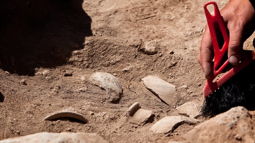
Archaeology is another field that benefits greatly from ground-penetrating radar systems. It provides archaeologists a robust amount of subsurface data to ensure their excavation efforts are successful. Long before they ever break ground, they can use GPR to build accurate readouts of where artifacts are buried and identify any risks before sinking a single shovel.
Even law enforcementputs GPR systems to great use. The technology has been used in various scenarios, such as helping officials locate caches of evidence buried by criminals or even helping to locate the remains of homicide victims. When law enforcement is racing against the clock, they rely on ground-penetrating radar to hasten their investigations.
These highly cost-effective and non-disruptive approaches provide several advantages over other surveying techniques.
- It’s noninvasive and non-destructive, it’s safe to use in public areas.
- Data collection at the site is quick and mobile, making it excellent for large area scanning.
- It provides accurate data about the depth, location and dimensions of large and small objects.
- Multiple frequencies provide variability and versatility in scanning at different depths and resolutions.
- Data can be interpreted in real time or processed off-site.
- Faster, safer and lower cost than other subsurface scanning methods.
Ground-penetrating radar offers an incredibly versatile method of locating, identifying and mapping various structures buried beneath the surface. The possible applications are virtually endless.
Learn More about GPR with US Radar
Ground-penetrating radar is an amazing technology with a wide variety of uses and applications. It’s no wonder it’s now a common tool in utility finding, archaeology and law enforcement, among many other industries. The advantages it offers over other methods of surveying are staggering.
At US Radar, we’ve been producing innovative ground-penetrating radar systems for more than 30 years. We develop industry-leading solutions for professionals and academics alike. Whether you need a cost-effective and quick method to locate utilities or a tool to help process a dig site, we’ve got you covered. With a global network of trained professionals, we’ll help you find the perfect solution for your needs.
To start learning more about GPR and how it can help you, contact us today.
![]()