

Most types of radar are used to detect objects like vehicles, ships, aircraft and even thunderstorms. In other words, the technology is most frequently used for locating and distancing objects above ground. Once a tool used only by the military and academia, advances in technology has enabled these same radar techniques to measure and detect objects underground on a commercial level.
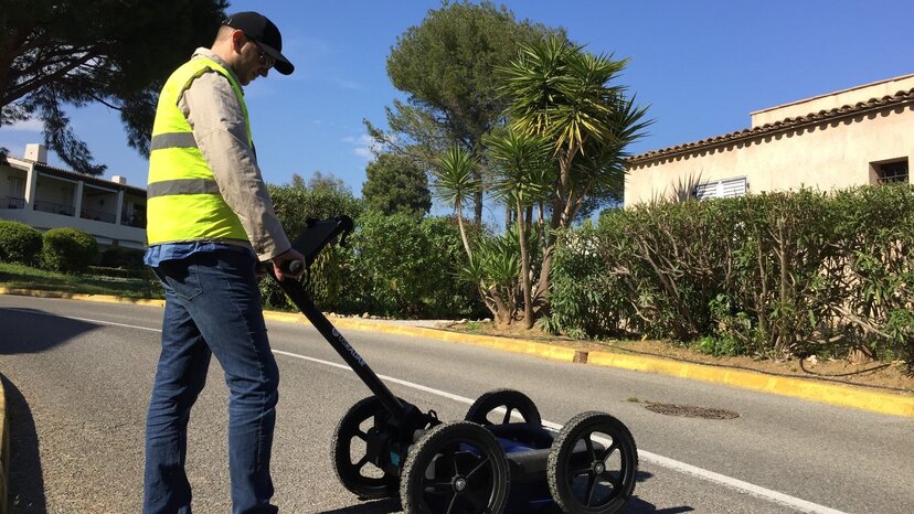
Ground-penetrating radar, otherwise known as GPR, is a geophysical method of location and measuring objects in the subsurface. Similar to above-ground radar systems, it works by sending pulses of electromagnetic energy into the target area and measuring the changes in the reflections of energy pulses to determine the location and depth of the target object.
But given what we know about geophysical materials, how accurate is the ground-penetrating variety at locating and measuring objects underground?
Understanding GPR Accuracy
When it comes to locating objects in subsurface material, ground-penetrating radar is incredibly accurate. A computer records the strength and time for the return of electromagnetic pulses and leverages sophisticated filters, called algorithms, to display this information on-screen for the operator. When the operator knows how to interpret these readings, GPR is a powerful device.
The accuracy of GPR consists of a few different factors, namely radar frequency and how accurately the dielectric constant of the surrounding material is determined. Understanding how these things come together helps improve the accuracy of these systems.
The whole system works to generate feedback by measuring the responses from energy pulses and displaying them on screen either in the form of arch-shaped images called hyperbola/parabola, disturbances, or layers. With a hyperbola, an important distinction to make is that pulses travel into the ground in a cone shape, which is why readings are displayed in arches on the screen. The lower points in the hyperbola are when the target is either in front of or behind the antenna and therefore further away. The highest point in the hyperbola is when the object is closest or directly below the center of the antenna.
Targets such as pipes, telecommunication cables, rocks and even buried artifacts may generate this same kind of arch on the display. However, due to a host of variables, sometimes hyperbolas may not appear clearly in data. Instead, a “disturbance” is seen. Disturbances appear as a jumble of data. This is often evidence of an installation trench as it is impossible for soils to sit the same way in post-excavation as it did prior.
Despite GPR’s potential, it’s not without variables that impact the accuracy. When determining how effective GPR will be in a given scenario, it’s critical to understand these variables and know how to compensate for them.
The Impact of Frequencies on Accuracy
One of the biggest variables in GPR accuracy is the frequency used. Ground-penetrating radar systems operate in the microwave band of the electromagnetic spectrum, and the systems manufactured by US Radar range between 100MHz to 2000Mhz. The frequency used depends on the field conditions you’re surveying in as well as the type of target object you’re locating and its depth. This means it’s absolutely crucial to implement a solution that matches your intended use cases if you want to maximize accuracy.
Generally speaking, the higher the frequency, the greater clarity you’ll have. Higher frequencies provide much higher resolution imaging, showing clearer information of the objects in the subsurface. The downside is that these higher frequencies dissipate much quicker and don’t go very deep — often only a few feet or meters.
For example, a frequency of 1000 MHz can only penetrate about six feet/two meters into a material, such as dry sand. Conversely, this same frequency can only reach about six inches/ fifteen centimeters in wet clay. This is due to properties of wet clay that cause a spreading of the radar pulse.
In the same scenario, a lower frequency antenna, such as 100MHz, can transmit 100 feet/30 meters or more in dry sand while only reaching 40 feet/12 meters in wet clay. In this scenario, however, the lower frequencies will have a lower resolution, and it will only be possible to detect large objects. In the case of very deep objects detected by a 100 MHz antenna, a minimum target size of .5’ to 15cm is not unrealistic. Also, while the accuracy of the depth and location of the object is still high, the details are much less so.
How Environment Impacts Accuracy
Despite frequency’s impact on depth and accuracy, environmental conditions have the biggest impact on how accurate GPR will be for any given application. Because GPR measures reflections of electromagnetic pulses in the ground to determine the location and depth of objects, these measurements are weaker in environments where the spreading of radar energy is high. This spreading of radar energy is called attenuation.
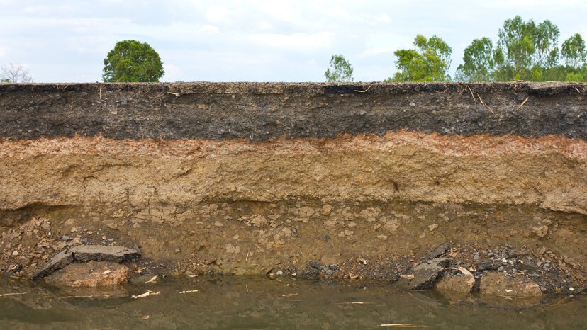
Ground material comprised of dense, wet clay has a much higher attenuation than other materials. This kind of material quickly absorbs the electromagnetic pulses, making accurate depth measurements more difficult. With a system operating at 250MHz, the signal only travels about 14 feet/4 meters.
On the other hand, ground conditions that are less dense and drier, such as sand or dirt, allow the pulses to travel much further and provide much more accurate data about the objects in the material. Under these circumstances, the same 250 MHz signals can travel 30 feet/9 meters or more.
One strategy in compensating for environmental differences and improving accuracy is to utilize a system that leverages multiple frequencies. These systems operate with multiple frequencies simultaneously and combine the data with cutting-edge software to provide greater depth and higher resolution imaging of the subsurface material.
Unlike other GPR manufacturers, US Radar offers the world’s first and only true Triple Frequency systems, in the Quantum Imager and GP Rover. Both systems display 1000MHz, 500MHz, and 250MHz data at the same time. Gone are the days of switching antennas because the target was deeper than expected.
The vertical accuracy is most directly determined by how accurately the dielectric constant of the material between the antenna and target is calculated. This value is used to convert the signal’s two way travel time into a distance or depth. Oftentimes a rough starting point yields depth accuracies within +/- 10% based on a rough estimate of the moisture content of the material. This accuracy can be further increased by several different calibration techniques such as 1) tracing a hyperbola on screen 2) entering in a depth to a known target 3) trial and error velocities in post-processing techniques. With these methods, it is possible to get depths accurate to within a couple percent of detectable objects. In cases, where a trench is visible instead of the utility itself, the 2d position is still highly accurate, but depth information just needs to be determined by other means.
Demonstrations of GPR Accuracy

While GPR use is certainly impacted by external factors such as ground and soil conditions and variable frequencies, proper use of the system and understanding the provided data improve that accuracy immensely. To understand how it all comes together, it’s worth examining some real-world approaches to maximizing GPR accuracy.
Determining the exact location and size of a subsurface void
Ground-penetrating radar systems are perfect for identifying voids in subsurface soil. With great precision, they can determine the depth the void resides as well as accurately detect the void’s boundaries. The caveat here is that GPR can’t accurately measure the depth of the void from top to bottom, just its presence.
Scanning non-ground surfaces, such as vertical surfaces and ceilings
Ground-penetrating radar systems are very effective in every subsurface application, and this certainly includes scanning walls, ceilings and other non-ground surfaces. It’s useful for accurately locating objects hidden within walls or even in scanning the underside of a floor to locate conduits and reinforcements.
Locating unmarked gravesites
In most situations, ground-penetrating radar is an excellent method for locating and identifying unmarked graves. This is especially useful in gravesite planning or even construction where the location of graves is uncertain. It’s also incredibly useful for archaeological applications where operators are searching for historical grave sites or burial grounds.
Utility identification and location
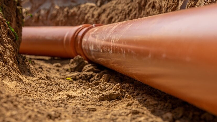
Ground-penetrating radar systems are the best method for locating all types of utilities, but do work best when combined with other technologies to give the field personnel as much information as possible. From communication cables to sewer and storm drains to gas and oil lines, GPR systems provide a highly accurate method for determining the location and depth of utilities. Because of its ability to locate both metallic and non-metallic targets, it’s not inhibited by the type of utility being surveyed, unlike other technologies.
Improving GPR Accuracy
Even with environmental limitations, operators can improve their accuracy by applying some simple techniques. The first of which is to simply understand the environmental variables at play and how those variables impact ground-penetrating radar. Many of these variables can be overcome through using GPR systems with multiple frequencies.
The other way to improve accuracy is by knowing how to physically use the GPR system effectively. Different environments call for different scanning approaches. For example, you can improve accuracy when scanning long, linear targets, such as cables and pipes, by approaching them at 90-degree angles.
A method that works well in good soil conditions is to cross and mark as you go. This is similar to existing methods for utility detection in that the operator sweeps the cart adjacent to where they expect the utility to be and manually marks it. This can also be done in the software by tapping on the screen and placing data points. If the unit is GPS equipped, it is possible to create maps directly in the radar software. These data points can then be easily exported to multiple mapping and engineering softwares.
Ground-penetrating radar’s unique ability to locate objects in the subsurface and provide contextual data about their location and size is invaluable. But for maximum accuracy, it does require some training and a little practice. Even still, it’s not something that requires years of experience. Many operators find they can produce highly accurate results after a single day of practice.
Increase GPR Accuracy with US Radar
![]()
Despite the complicated science behind GPR, understanding the mechanics behind how it works helps improve performance in the field. More importantly, with the right training and experience, ground-penetrating radar systems can provide highly accurate subsurface data without ever breaking ground. Learn more about GPR with US Radar.
At US Radar, we’ve been perfecting ground-penetrating radar systems for more than 30 years. As an industry leader, we know that helping our customers apply the best methods and techniques is just as important as the quality of our products. This is why we have a global team of experts to help during every step of your GPR journey. We’ve helped countless professionals get the most from their GPR.
If you’re ready to add an innovative GPR system to your arsenal, we can help. Get in touch today to get started.


