

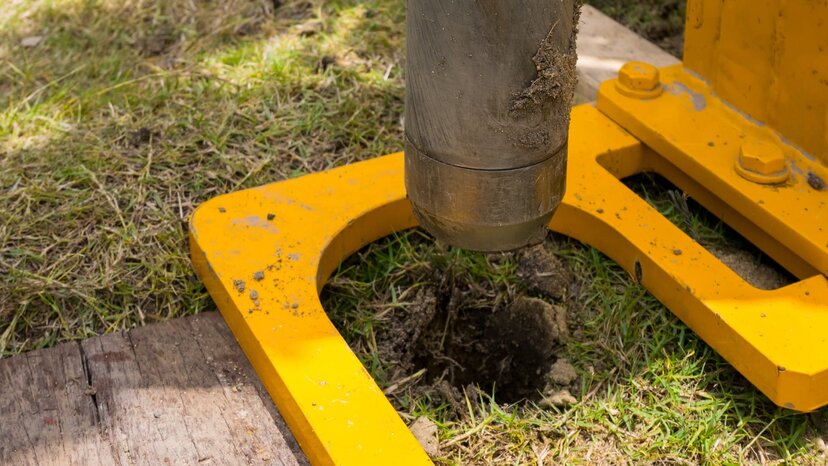
If you’re already familiar with ground-penetrating radar, or GPR, the technology probably brings to mind operators searching for buried utility lines or engineers locating structural rebar in cement foundations. With good reason: GPR is an exceptional solution for these applications.
But GPR has some other, more surprising, uses.
The technology works by way of electromagnetic pulses. These pulses are transmitted into the ground and bounce back to the GPR receiver, providing accurate visual data of the subsurface material and the objects within it.
This non-destructive approach makes GPR an effective solution for a variety of subsurface measurements. And because it doesn’t require breaking any ground, the technology works in a wide variety of applications, making it incredibly versatile for use in numerous industries.
The Benefits of GPR Technology
Traditional exploration methods, such as drilling and coring, provide subsurface information — but only in a few specific spots. To obtain any amount of usable data, engineers and surveyors need samples from multiple locations across exceedingly wide areas of a project site. These traditional subsurface surveying methods are costly and time-consuming and, in many cases, don’t provide very accurate data.
Compared to coring and drilling, GPR provides far superior data in a fraction of the time, all without breaking the surface. And in situations where penetrating the soil isn’t an option, other geophysical location methods can’t compare to GPR.
A few of the things GPR can locate include:
- Underground objects, including metal, non-metal, PVC and any other material
- Changes in ground strata, soil disturbances, air pockets and voids
- Groundwater tables, bedrock and other geological features
With the right GPR solution, surveying subsurface material is also much easier compared to other methods. With minimal training, operators can get up and running with GPR and begin mapping and measuring a variety of subsurface materials, from rock and soil to cement and pavement, with ease.
5 Surprising Uses for GPR
Locating, mapping and measuring underground objects isn’t an easy task. Choosing the right surveying method depends on the goals of the project, the survey site and the skill set of those involved. Professionals who regularly survey subsurface materials likely have a variety of approaches depending on survey requirements.
That said, in addition to the benefits outlined above, GPR is one of the most versatile methods available for subsurface surveying. So much so that a variety of professionals across countless industries depend on it regularly.
Here are just a few of the surprising uses of GPR.
1. Mining and Quarrying
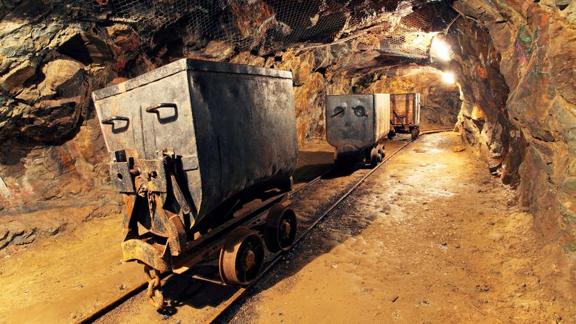
In the mining industry, GPR is an incredibly versatile tool. Operators use GPR to provide engineers and other stakeholders with information about existing mine shafts, including location, depth and structure. This kind of mapping data is invaluable during the early planning stages of mining and quarry projects. GPR also identifies potential hazards in aging mines, providing crucial safety information before any personnel set foot in a mine shaft.
GPR is also useful for analyzing rock and soil layers, determining rock and mineral quality and even identifying optimal excavation locations. Many mining professionals depend on GPR for the early analysis of a potential project site.
2. Snow and Frost Analysis
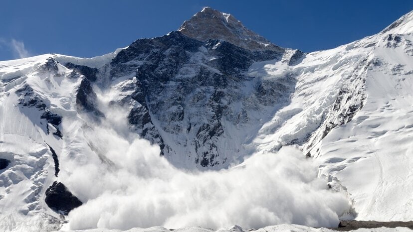
GPR works exceptionally well in ice and frost, making it a useful tool for measuring depth and thickness, layer structure or locating objects buried within. This is handy in a variety of applications, such as polar and Antarctic ice research, where accurate measurements are necessary for determining climate change impact. It’s also useful for determining safe passage across ice sheets and measuring fresh-water ice to help predict melt runoff and mitigate flooding.
GPR works equally well in snow, making it a useful tool for predicting and monitoring avalanche conditions. And when the worst happens, it’s a viable search and rescue tool for rapidly locating victims buried within the snow and ice.
3. Environmental and Humanitarian Applications
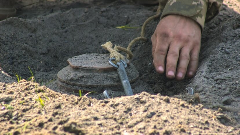
For environmental scientists, GPR is an essential tool used to assess subsurface materials. These scientists depend on the technology to locate environmental risks such as hazardous waste materials in the ground or buried chemical drums. It’s also effective at assessing and measuring landfills.
GPR is also indispensable in humanitarian and military efforts, such as locating dangerous landmines, bombs and other explosive remnants of war. It’s equally effective at locating underground tunnels and chambers that might hold other dangerous objects or persons.
4. Archeology
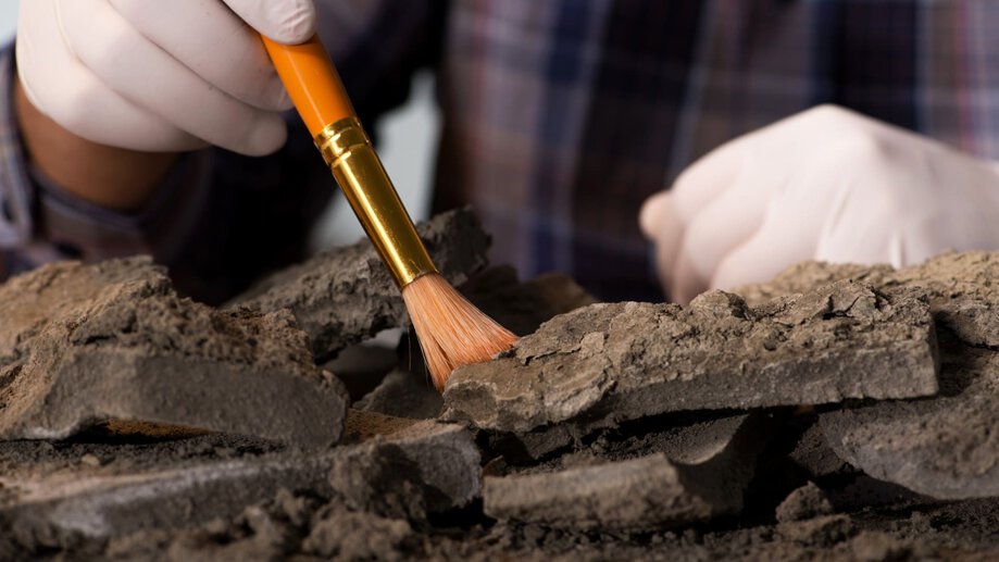
When it comes to increased accuracy and minimal disruption, imaging with GPR is crucial across a variety of industries. But few fields benefit from GPR’s non-invasive approach as much as archeology. Preventing damage to priceless structures and artifacts is critical to the success of an archeological excavation, and GPR is immensely valuable to archeologists across the globe.
Given its versatility, GPR is surprisingly useful in situations where modernity impedes archeological efforts. In one such example, archeologists used GPR to locate the potential grave site of King Henry I beneath a paved parking lot.
5. Agricultural Applications

Many farmers and other professionals depend on GPR for their ongoing operations in agriculture. Crop planning, for example, often requires accurate soil surveying that’s costly to obtain with other methods. With GPR, surveyors can analyze soil conditions and locate buried objects that could prevent healthy crop growth.
GPR is also the perfect tool for planning the construction of underground sprinkler and irrigation systems as well as for locating tiles and other components of drainage systems. And because GPR can identify water and other liquids in the soil, it’s equally effective for maintaining and repairing existing systems.
That said, while GPR is extremely versatile and useful for a variety of agricultural applications, it is not the perfect tool for every situation. To date, experiments to use GPR for root mass analysis have been inconclusive and this is not a recommended application at this time.
Find Out How GPR Can Help You
![]()
If you’re considering a subsurface solution for your next project, but you aren’t sure where to start, US Radar can help guide you. Our products have helped thousands of professionals in countless industries map, measure and analyze subsurface materials. Throughout our two decades of designing and engineering GPR solutions, our customers still surprise us with new ways of using our innovative systems.
With a worldwide network of knowledgeable professionals, US Radar can help you find the right solution and make sure you have everything you need for survey success, now and in the future. To find out more, get in touch with us today.


