
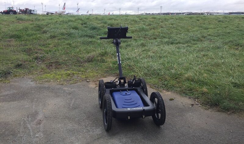
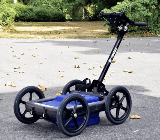
Q10 Utility and Geotechnical Locating System
The Q10 is a high-resolution 1000 MHz ground-penetrating radar system built for shallow utility locating, bridge deck analysis, and structural assessment. Its self-calibrating GPR antenna and StreetSmart real-time processing enable you to power on and start scanning within minutes. This GPR unit is designed and built in the USA, backed by US Radar’s 30+ years of field-informed subsurface imaging technology.
High-Resolution GPR Scanning at Shallow Depths
Ground-penetrating radar works by sending radar waves into the ground and capturing the reflected signal when those waves encounter subsurface objects or changes in subsurface materials. The Q10’s software automatically processes this GPR data into a clear visual profile, so you see results in real time without manual data interpretation.
At 1000 MHz, the Q10’s GPR antenna produces short, focused radar pulses that excel at resolving closely spaced targets and detecting small buried objects. This frequency range is optimized for high-resolution imaging at shallow depths, making the system particularly effective in areas where plastic conduits, utility lines, and buried utilities are densely packed. While lower frequencies penetrate deeper, the Q10’s higher frequency range provides the detail that bridge deck analysis, structural assessment, and precision shallow utility locating applications demand.
Self-Calibrating Antenna Technology
The Q10’s self-calibrating single-frequency antenna automatically adjusts to surrounding soil conditions. Simply power on the GPR unit, let it auto-calibrate, and begin your GPR survey. The Autoconfiguration technology reads the electromagnetic properties of the ground beneath you and optimizes settings for the clearest possible data, ensuring consistent results across varying field conditions.
Real-Time Data Collection with StreetSmart Processing
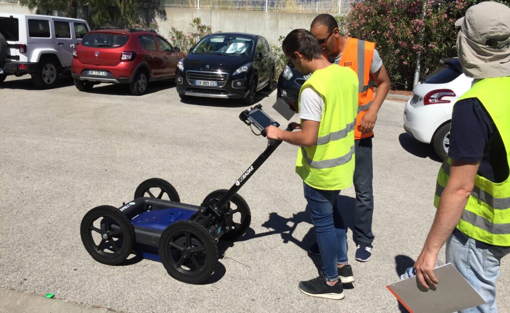
The Q10’s StreetSmart real-time processing displays GPR data as you scan. The system presents subsurface findings on screen as you move across the survey area, allowing you to identify targets, mark locations, and make field decisions immediately.
Automated Signal Enhancement and Depth Calibration
SmartGain2 and SmartStack work automatically to maximize the quality of every GPR signal. SmartGain2 applies time-varying gain so deeper targets appear clearly alongside shallow ones, while SmartStack combines multiple radar pulses to bring subtle subsurface features into sharper focus. You focus on scanning while the Q10 optimizes signal quality in the background.
The system’s depth calibration feature automatically sets velocity values for accurate depth calculations. Radar waves travel at different speeds through different subsurface materials, and the Q10 accounts for this, so your depth readings reflect true measurements. This automated calibration applies consistently across your entire GPR survey.
Hardware Built for Field Conditions
Durable Getac Tablet Interface
The Q10 pairs with a Getac F110 tablet featuring a 1200-nit daylight-readable, weatherproof display. The high-performance Intel Core i5 CPU enables real-time data processing with built-in 3D-view capability, Wi-Fi, USB, Ethernet, and HDMI connectivity. MIL-STD-810H and IP66 certifications mean the tablet handles temperature extremes, vibration, and 6-foot drops, keeping your GPR equipment operational in demanding field conditions.
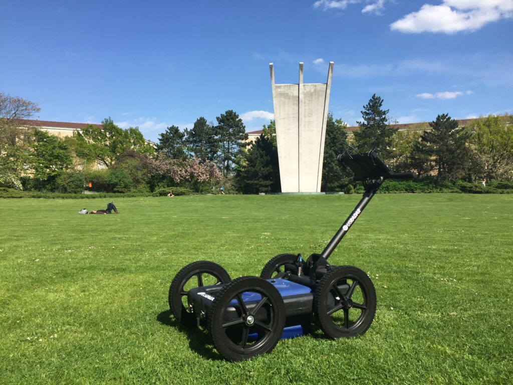
Rugged All-Terrain Cart
The Q10’s folding rough terrain cart features airless solid tires that can’t go flat and require no maintenance. The sloped antenna design glides over obstacles, and military-grade connectors provide secure connections between the GPR antenna and controller. A folding handle makes storage and transport practical, and each long-life battery pack provides up to 8 hours of continuous runtime.
Software and Data Processing
The Q10 comes equipped with US Radar’s Radar Acquisition Software, the core field software that processes raw GPR data into clear visual formats in real time. You can mark and label points, measure distances, and enhance images at particular depths while recording everything as a permanent digital record.
For advanced post-processing, Radar Studio transforms ground-penetrating radar data into dynamic visuals with annotation, depth slices, and export capabilities including CAD files and Google Earth integration. Radar Studio also integrates GPS data and mapping features, enabling you to overlay as-built maps with radar data for precision locating.
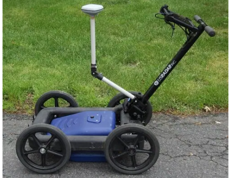
The Q10 supports optional GPS integration with a dedicated pole mount that centers GPS directly over the antenna. It works with most high-end GIS and RTK units for generating georeferenced point files that export into popular mapping software.
Q10 Applications Across Industries
Shallow Utility Locating
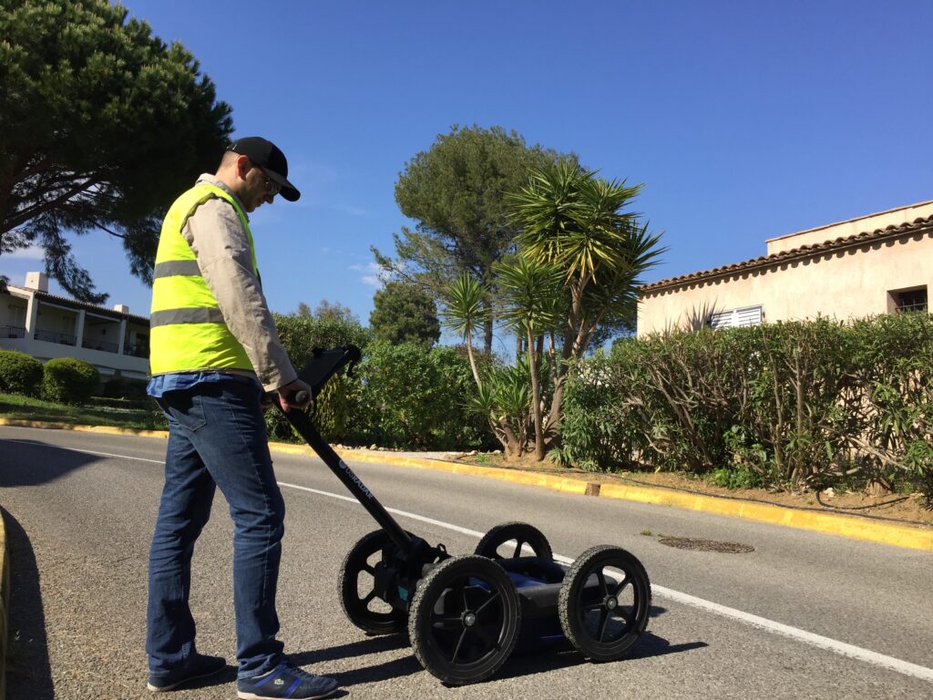
In urban environments where underground utilities are densely packed at shallow depths, the Q10 differentiates closely spaced targets including metallic and non-metallic utility lines, plastic conduits, and fiber optic cables. Real-time data display means you identify and mark buried utilities on site without waiting for office-based review.
Bridge Deck and Structural Assessment
For structural assessment applications, the Q10’s high-frequency GPR scanning reveals embedded objects and subsurface anomalies within structural elements. Bridge deck analysis benefits from the system’s ability to detect deterioration, voids, and changes in material composition at the shallow depths typical of these applications.
Geotechnical and Environmental Investigation
The Q10 supports geophysical and environmental investigations where high resolution near-surface imaging is essential. As a non-destructive geophysical method, GPR scanning eliminates the need for exploratory drilling at every investigation point, mapping subsurface layers and assessing soil conditions while reducing site disturbance.

Frequently Asked Questions
How does the Q10 ground-penetrating radar system work?
The Q10 sends radar waves into the ground through its GPR antenna. When those waves encounter buried objects or changes in subsurface materials (such as a pipe, conduit, or void), a portion of the radar signal reflects back. The receiver antenna captures this reflected signal, and the system’s software automatically processes the data into a clear visual display in real time. The entire process is non-destructive, imaging what’s beneath the surface without excavation or drilling.
What can the Q10 detect?
The Q10 detects a wide range of subsurface objects and features at shallow depths: metallic and non-metallic utility lines, plastic conduits, fiber optic cables, voids, embedded objects, and changes in subsurface structures. The 1000 MHz frequency range is specifically optimized for high resolution imaging of targets close to the surface.
What affects GPR depth and accuracy on a project site?
Soil conditions are the primary factor. GPR performance varies based on the electrical properties of subsurface materials, particularly electrical conductivity. Sites with high conductivity materials (such as wet clay soils) generally limit detection to near-surface disturbances. Drier, sandier soils with lower conductivity allow greater depth penetration. The Q10’s self-calibrating antenna automatically adjusts to site conditions, optimizing performance for your environment. For soil composition identification, excavation and coring remain the only reliable methods, though GPR can map subsurface layers effectively.
Do I need specialized experience to operate the Q10?
No. The Q10 is designed so anyone can operate it confidently. The self-calibrating antenna, Autoconfiguration, and StreetSmart real-time processing handle the technical work automatically. Power on, auto-calibrate, and start your GPR survey. SmartGain2 and SmartStack optimize signal quality in the background, and the Acquisition Software displays findings in an easy-to-understand format.
Is ground-penetrating radar scanning safe on job sites?
Yes. GPR systems use low-power electromagnetic energy to image the subsurface, making them a safe, non-invasive geophysical method. There’s no radiation hazard, no need to clear the area, and no risk to nearby workers or structures. The Q10 operates in occupied spaces and active job sites without safety restrictions.
What software comes with the Q10?
The Q10 includes Radar Acquisition Software with the Basic package for field data collection, real-time display, auto-calibration, and recording. You can add Radar Studio for depth slices, 3D imaging and modeling, GPS overlay, and CAD/Google Earth export. Data is also compatible with third-party software packages.
How does the Q10 compare to other US Radar systems?
The Q10 excels at high-resolution, shallow-depth applications with its 1000 MHz single-frequency antenna. For greater depth, US Radar’s triple frequency systems (the Quantum Imager and GPRover) detect targets up to 30+ feet deep with three simultaneous signals. The Q25 supports moderate-depth geophysical applications at 250 MHz, and the Q5 Series provides a budget-friendly option for basic utility locating. Our system selection guide can help you choose.