
Ground-Penetrating Radar Systems
Precision Below the Surface
For over 30 years, US Radar has designed and built reliable ground-penetrating radar systems that deliver clear results on the spot, even in the toughest conditions. Whether you’re identifying underground utilities, confirming subsurface features, or conducting geophysical surveys, our GPR technology is tested in the field and trusted by professionals worldwide.
We make it possible to see beneath the surface without disturbing the ground. Built for accuracy, flexibility, and clarity, our GPR equipment supports a range of applications from urban utility locating to remote geological surveys and archaeological investigations.
What Is a Ground-Penetrating Radar System?
A ground-penetrating radar system uses low-power electromagnetic waves to detect and map subsurface materials. It sends short bursts of radar pulses into the ground using a transmitter antenna. When those radar waves encounter something with different dielectric properties (such as a pipe, void, or rebar) they bounce back. A receiver antenna captures the reflected signal, producing a detailed profile of the subsurface structures below.
This non-invasive geophysical method is based on the interaction between electromagnetic properties and contrasting subsurface materials. That makes GPR technology ideal for detecting everything from buried objects and utility lines to changes in soil layers and subsurface contamination.
How Electromagnetic Waves Map the Subsurface
GPR works by transmitting an electromagnetic pulse into the ground surface. As radar waves travel through subsurface materials, they move at different velocities depending on the dielectric permittivity of each layer. When these waves hit a boundary between materials with contrasting electromagnetic properties, a portion of the energy reflects back toward the receiver antenna.
The time it takes for the reflected signal to return determines the object’s depth. The signal’s strength provides additional clues about the target’s size, depth, and orientation. This principle enables accurate measurements of depth and location across a wide range of subsurface investigations.
Applications Across Industries
US Radar’s ground-penetrating radar technology helps solve real-world challenges across diverse industries and project types.
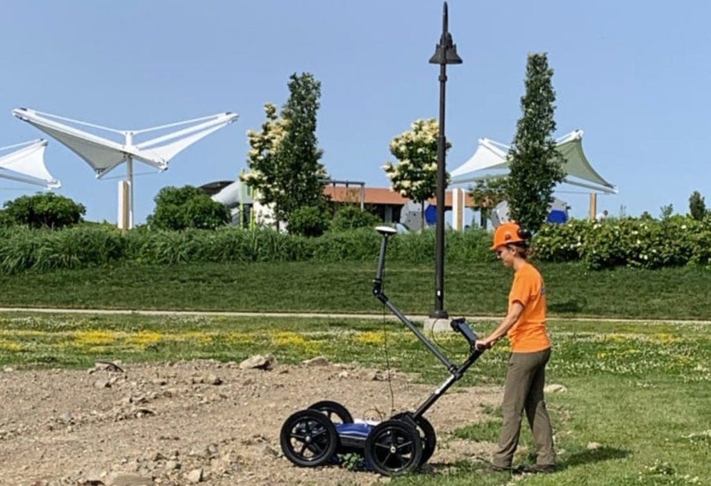
- Utility Locating and Mapping – Utility locating is one of the most common GPR applications. Our systems detect gas pipes, water mains, conduits, fiber cables, and other buried utilities, including non-metallic targets like plastic pipes and fiber optic lines. The GPRover utility mapping system combines triple frequency GPR with precision GPS connectivity to create subsurface utility maps in real time, enabling rapid data collection without base stations or control points.
- Construction and Infrastructure – Construction projects benefit from GPR surveys that reveal subsurface anomalies ahead of excavation. Professionals use GPR investigation to locate rebar, post-tension cables, underground storage tanks, and unexpected voids before breaking ground. This reduces risk, prevents costly utility strikes, and keeps projects on schedule.
- Environmental and Geophysical Studies – GPR serves as an indispensable tool for environmental investigations, detecting subsurface contamination, mapping groundwater contamination plumes, and identifying underground storage tanks. For geophysical research, our systems map soil layers, ice thickness, and subsurface features with unsurpassed depth penetration.
- Archaeology and Forensics – Archaeological professionals rely on GPR to locate buried objects and map subsurface structures without disturbing sensitive sites. This non-invasive approach preserves archaeological context while providing detailed analysis of what lies below. Law enforcement and forensic teams also use GPR investigation to locate evidence and identify areas of disturbed soil.
Choosing the Right GPR System
Every project has unique requirements for depth penetration, resolution, and frequency range. US Radar manufactures a complete line of GPR systems designed to match specific application needs.
Understanding Frequency and Depth
The relationship between frequency range and depth penetration is fundamental to selecting the right GPR equipment. Higher frequencies deliver sharper detail and high-resolution imaging but reach only shallow depths, making them ideal for structural assessment or tight urban environments. Lower frequencies provide greater depth penetration with less resolution, suited for deep utility locating or geological surveys.
Our triple-frequency systems solve this trade-off by emitting three separate signals simultaneously. You get both depth and detail without switching antennas or making multiple passes. The Quantum Imager was the first true triple-frequency-range GPR system ever produced, generating three independent datasets that can be viewed and cross-compared for superior accuracy.
Antenna Configurations
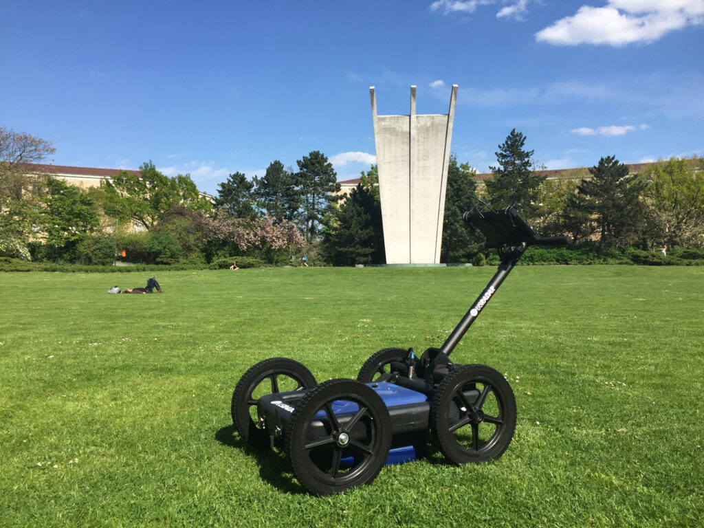
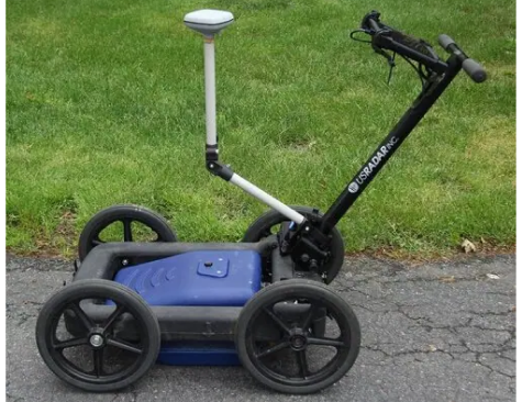
Common offset configuration and paired antenna setups offer flexibility in how GPR data is collected and displayed. US Radar systems are designed for rapid deployment and straightforward operation. Simply connect the battery, power on, auto-calibrate, and start scanning. You’re collecting accurate subsurface data from your first pass.
US Radar GPR Systems: Built for Results
Our product lineup includes:
100 Series: Deep penetrating-radar for geophysical research and tunnel detection, capable of reaching depths up to 100 feet.
Q25: A single-frequency 250 MHz GPR unit for clear imaging of subsurface anomalies at moderate depths.
Q10: High-frequency GPR antenna system for shallow utility locating in urban environments.
Q5 Series: Budget-friendly GPR equipment for basic utility locating and electromagnetic property detection.
Quantum Imager: Triple frequency system delivering high resolution imaging across multiple depth ranges with direct RF sampling technology.
GPRover: Integrated GPR system with GPS mapping for advanced utility mapping, accurate within 2 inches (5cm) without a base station.
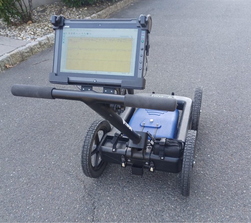
Each GPR unit is engineered for durability, ease of use, and adaptability. With up to 8 hours of battery life, weather-resistant Getac tablet interfaces, and rigid airless tires, these systems are ready for any field condition.
Data Processing and Interpretation
Collected radar data becomes actionable through our comprehensive GPR software ecosystem. The Radar Acquisition Software processes raw data in real time, displaying findings as you scan. You can mark and label points in the radar data, measure distances, and enhance images at specific depths using time-varying gain.
Advanced Post-Processing
For detailed analysis and professional deliverables, Radar Studio transforms raw GPR data into dynamic visuals with advanced annotation, depth slice creation, and export capabilities. The software seamlessly integrates GPS data, enabling as-built maps to be imported and compared with radar data containing GPS coordinates for precise location verification.
Data processing outputs include CAD files, Google Earth files, and GIS-compatible formats. This flexibility in data interpretation means you can share, archive, and present findings in whatever format your project requires. All US Radar systems are also capable of having their data presented in 3D format for enhanced visualization of subsurface objects and features.
Why Professionals Trust US Radar
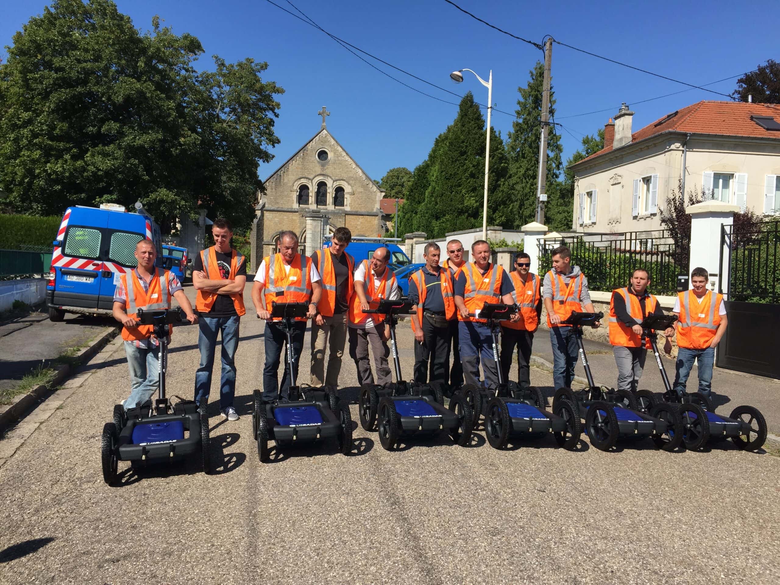
US Radar is more than a GPR manufacturer. We’re a partner in subsurface exploration success, with 30+ years of field experience driving every product decision.
Our systems are designed and built in the USA with durable parts that last. You get clear, honest support from engineers who know fieldwork, along with proven reliability across tough conditions, urban sites, remote terrain, and mixed soil. Every GPR system we build reflects real-world input from the professionals who use them, ensuring our technology solves the challenges you actually face in the field.
When you need reliable subsurface data, our ground-penetrating radar systems deliver with confidence. You’ll get the data you need, in the format you need it, with the accuracy your projects demand.
Get the Right GPR System for Your Project
Whether you’re scanning for utility lines, identifying subsurface anomalies, or planning a multi-phase GPR investigation, the right equipment makes all the difference. Our team helps you choose the best system for your depth, frequency, and reporting needs.
With more than 30 years of field experience and a product range that supports both seasoned specialists and new users, US Radar is a trusted partner in ground-penetrating radar. Contact us today to match your application with the right technology and configuration.
Frequently Asked Questions
What is a ground-penetrating radar system used for?
A GPR system detects and maps subsurface structures, including utility lines, buried objects, and structural elements. Common applications include construction projects, geophysical surveys, archaeology, environmental investigations, and utility mapping. GPR is a non-invasive geophysical method that creates a profile of what lies beneath the ground surface without excavation or drilling.
How deep can GPR systems detect?
Depth depends on frequency range and ground conditions. Lower frequencies achieve greater depth penetration, while higher frequencies provide more detail at shallow depths. US Radar systems detect targets up to 30+ feet deep with most models, and up to 100 feet with the 100 Series geophysical scanner. Actual depth performance is influenced by soil conditions, electrical conductivity, and the dielectric properties of subsurface materials.
What frequency GPR do I need?
The right frequency range depends on your application and target depth. Higher frequencies (like those in the Q10) deliver high resolution imaging at shallow depths, ideal for locating targets in urban environments. Lower frequencies (like the Q25 at 250 MHz) provide greater depth penetration for geological surveys and deeper subsurface investigations. US Radar’s triple frequency systems (the Quantum Imager and GPRover) emit three separate signals simultaneously, so you get both depth and detail without switching antennas.
Does GPR work in clay or wet soil?
GPR systems can operate in wet clay soils, but performance is generally limited to detecting near-surface disturbances in these conditions. Soils with high electrical conductivity absorb radar signals more rapidly, which reduces depth penetration. Our systems auto-calibrate to surrounding soil conditions to maximize detection within the available range. For the most accurate understanding of soil composition at your site, excavation and coring remain the only reliable identification methods.
What affects GPR signal quality?
Electrical conductivity, dielectric permittivity, signal attenuation, and soil moisture all influence GPR performance. Materials with high electrical conductivity (like wet clay soils) reduce the depth at which subsurface objects can be detected, though GPR can still identify near-surface disturbances in these conditions. US Radar’s Acquisition Software automatically adjusts processing settings to account for these variables, giving you the clearest possible results.
Can GPR identify the type of material underground?
GPR systems can map subsurface layers and detect contrasts between different materials, but they cannot identify specific material type. What GPR detects is the boundary between materials with different dielectric properties. A skilled operator can interpret the size, depth, and shape of a target, but confirming exact material composition requires excavation or coring. This is an important distinction when planning subsurface investigations.
How do I export GPR data for CAD or GIS?
US Radar systems support multiple export formats for seamless data integration. Radar Studio post-processing software exports to CAD files (.dxf), Google Earth files (.kmz), and GIS-compatible formats (.shp). The GPS integration module enables operators to generate georeferenced point files that import directly into popular mapping software. This means your GPR data becomes a permanent, shareable digital record that all project contributors can access.
What is the difference between 2D and 3D GPR imaging?
Standard GPR surveys produce 2D cross-section profiles of the subsurface as you move the antenna along a line. 3D imaging combines multiple parallel survey lines into a volumetric dataset, allowing you to view depth slices and plain view images that reveal the full spatial extent of buried objects and subsurface features. All US Radar systems can present data in 3D format with the appropriate software package.
What is triple frequency GPR technology?
Triple frequency technology means the GPR antenna emits three separate signals simultaneously across low, mid, and high frequency ranges, generating three independent datasets from a single pass. US Radar introduced this capability with the Quantum Imager in 2014, making it the first true triple frequency range GPR system ever produced. Unlike single frequency systems that optimize for one depth range, triple frequency provides comprehensive coverage from shallow to deep targets. The three datasets can be viewed and cross-compared for superior accuracy and confidence in your findings.
Is GPR safe near people and structures?
Yes. GPR uses low-power electromagnetic energy and does not disturb the ground surface. It is a completely non-invasive method that is safe for use in sensitive areas, near infrastructure, and around personnel. GPR surveys require no special safety equipment or restricted access zones, making them practical for active job sites and populated areas.
NEED HELP FINDING THE RIGHT GPR SYSTEM FOR YOU?
Don’t know which ground-penetrating radar system best suits your specific needs? We’re more than happy to help you decide. Contact us to speak with one of our team members about which system is right for you.