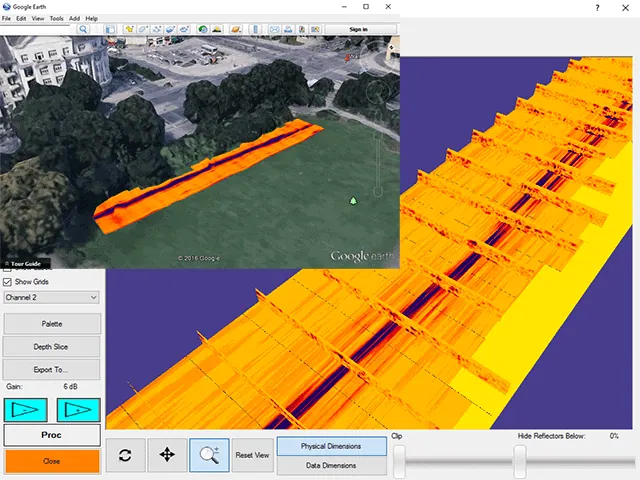
Integrating GPS with GPR technology allows you to maximize your location accuracy potential. By collecting data with GPS integration, you are creating a file that saves coordinates that you can reference for any future installation and maintenance projects in the field. GPS-integrated data can also later be transformed into dynamic visual maps with our optional post-processing software, Radar Studio. By creating a map based on your findings, you will provide greater context to your data and place yourself back at the jobsite without having to physically be there.
Integrate Your GPS With Ground-Penetrating Radar (GPR)
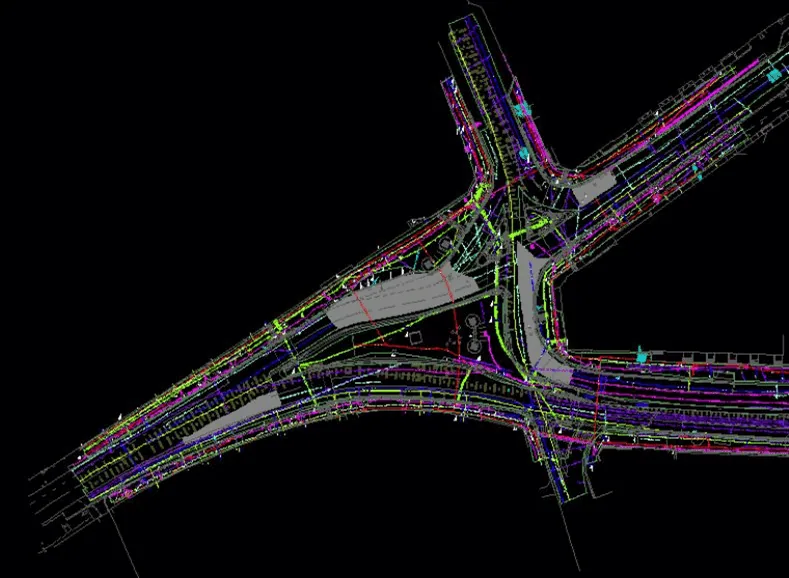
Our GPR software integrates consumer and high-end GPS units and integrates with mapping software such as ArcGIS, Auto-CAD, Google Earth, and others.
GPS Integration = More Accurate Location
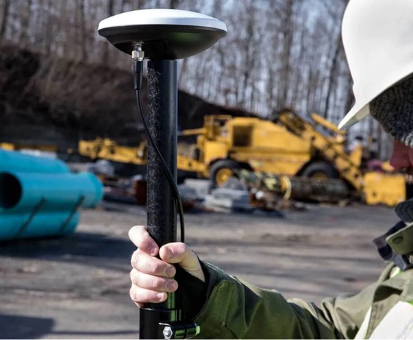
Enabled GPS compatibility using customer’s receiver
Works with most GPS units with external data output from handheld GIS units to RTK rovers
Receive NMEA strings through Bluetooth or USB
GNSS capable of processing positions utilizing GPS, Glonass, and Galileo constallations
Coordinates are displayed in data
Tap screen at target and coordinates for target are displayed
Recorded data will display coordinates on screen
Points an be exported as spreadsheet and/or can be imported into CAD and GIS applications