
Environmental Applications for Ground-Penetrating Radar
The Expanding Role of GPR in Environmental Science
Ground-penetrating radar has become an important geophysical method in environmental science. Its ability to map subsurface materials, locate buried features, and monitor environmental change makes it a valuable tool for environmental investigations and hydrogeological studies.
The environmental applications of GPR extend from groundwater monitoring and contaminant detection to the assessment of soil conditions, natural habitats, and underground storage tanks. Because the method is non-invasive, it provides high-resolution information without disrupting sensitive environments or built structures.
How Ground-Penetrating Radar Works in Environmental Studies
Core principles of electromagnetic wave propagation
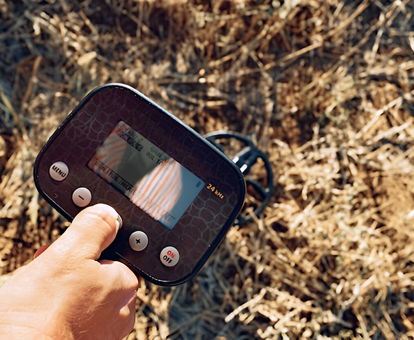
Ground-penetrating radar operates by transmitting electromagnetic waves into the ground and recording how those waves reflect from changes in material properties. The GPR antenna sends radar pulses into the subsurface, and the GPR receiver captures the reflected signal when the waves encounter materials with contrasting dielectric properties. These variations help define layers, voids, or other subsurface features that may pose environmental risks.
The resulting radar imaging produces continuous profiles or cross sections that show changes in subsurface environments, giving scientists a non-destructive look into what lies beneath the surface.
Frequency range and soil conditions
The effectiveness of GPR depends on both antenna frequency and soil conditions. High-frequency pulses offer greater detail but shallower depth, while low frequencies allow deeper penetration with less resolution. Soil moisture, electrical resistivity, and composition affect signal attenuation. For example, dry sand and granitic terrain promote deeper imaging, while clay-rich or salt-contaminated soils limit radar wave penetration.
By selecting the correct frequency range and accounting for soil conditions, operators can adapt each GPR survey to the site’s specific environmental challenges.
Environmental Applications of GPR
Groundwater exploration and hydrogeologic studies
One of the most valuable environmental applications of GPR is groundwater exploration. The technology helps map groundwater resources, identify aquifer boundaries, and characterize hydrogeologic properties. Because GPR can detect differences in dielectric permittivity caused by moisture variations, it can help define the movement of water through subsurface materials and support the development of hydrological models.
GPR also assists in mapping groundwater contamination by delineating contaminant plumes and defining pathways that influence groundwater quality. This data helps guide cleanup efforts and remediation planning.
Contaminant detection and remediation monitoring
Environmental investigations often rely on GPR to locate contaminated zones and monitor remediation over time. The ability to perform repeatable, non-destructive surveys makes GPR an effective option for ongoing monitoring programs. GPR data collected during cleanup efforts can reveal changes in subsurface conditions, providing real-time insights that help track contaminant migration under regulations such as the Safe Drinking Water Act.
Underground storage tanks and buried features
GPR is also commonly used to detect underground storage tanks and buried objects that may pose risks to human health or groundwater. The technique provides clear imaging of subsurface structures without excavation, allowing teams to identify potential hazards before construction
or redevelopment begins.
Because GPR systems can capture high-resolution subsurface images, they are well-suited for locating older, non-metallic tanks or other buried materials that traditional methods may overlook.
GPR in Environmental and Archaeological Investigations
Environmental and archaeological investigations often overlap, sharing similar goals of locating and mapping subsurface features without disturbing the ground. In applied geophysics, GPR helps identify unmarked graves, delineate karst features, and study natural habitats. Its ability to produce high-resolution images makes it ideal for assessing near-surface structures in sensitive or protected areas.
These applications demonstrate how GPR supports both environmental science and cultural preservation by combining non-invasive mapping with detailed subsurface imaging.
Interpreting GPR Data in Environmental Studies
GPR data analysis and interpretation
Turning raw radar data into actionable information requires skilled interpretation and an understanding of subsurface environments. Analysts review GPR scans to identify anomalies that may indicate contaminant zones, underground utilities, or geologic structure changes. The interpretation process uses radar imaging to visualize depth, continuity, and density contrasts within the soil and rock.
GPR results are typically displayed as depth profiles or 3D models that highlight variations in dielectric constant and other material properties. When integrated with environmental datasets, these images help guide decisions on remediation, site redevelopment, or groundwater protection.
Integration with other geophysical methods
GPR often works in combination with other geophysical methods such as electrical resistivity or seismic surveys. Each approach contributes unique information about subsurface materials and conditions. GPR provides high-resolution imaging of near-surface features, while other methods offer depth and compositional context. Together, they create a complete picture of subsurface environments that supports effective environmental decision-making.
Georeferenced utility data from GPR surveys also enhances mapping accuracy and ensures that environmental and engineering teams share consistent, verified information.
Advantages of Using GPR Technology for Environmental Applications
Ground-penetrating radar offers several benefits for environmental studies and monitoring projects:
- Non-invasive and environmentally safe data collection.
- High-resolution imaging of subsurface structures and contaminant pathways.
- Rapid survey capability across large or inaccessible areas.
- Cost-effective compared to invasive drilling or trenching.
- Compatible with hydrogeological and remediation monitoring programs.
- Adaptable to varied terrain, from granitic terrain to karst formations.
GPR technology provides reliable data that improves the accuracy of environmental assessments while minimizing disturbance to ecosystems or infrastructure.
Real-World Examples of GPR in Environmental Investigations
Ground-penetrating radar supports many environmental applications, including:
- Locating buried underground storage tanks during site redevelopment.
- Detecting groundwater contamination and tracking contaminant plumes.
- Mapping soil conditions and identifying nonpoint sources of pollution.
- Assessing subsurface materials near natural habitats and wetlands.
- Supporting archaeological and hydrogeological studies that align with environmental objectives.
Each of these applications demonstrates how GPR works as a precise, adaptable method for mapping and monitoring environmental conditions across diverse subsurface environments.
Using GPR for Better Environmental Decisions
The environmental applications of GPR continue to expand as technology advances. GPR allows scientists, engineers, and environmental specialists to locate buried objects, monitor groundwater contamination, and assess geological features that affect human health and safety. Contact us today to get started.
Frequently Asked Questions
How does GPR support environmental work?
What level of detail can GPR provide in environmental investigations?
How does GPR aid in identifying potential risks during a construction project?
Before excavation or redevelopment, GPR aids in mapping underground utilities and subsurface features that could interfere with work. The results obtained from GPR applications reduce the chance of unexpected hazards, helping ensure that construction remains safe and compliant while minimizing environmental impact.
Can organizations utilize GPR for pinpointing sources of contamination?
Yes. GPR can help identify point sources that contribute to groundwater contamination or environmental degradation. The penetrating radar method reveals structural changes and disturbed soils associated with leaks or old infrastructure, allowing teams to locate and assess affected zones efficiently.
Who uses GPR technology for environmental projects?
Environmental professionals, engineers, and customers nationwide utilize GPR for groundwater studies, utility mapping, and environmental monitoring. Because the built world increasingly depends on sustainable land use and accurate subsurface data, GPR has become a trusted solution for customers seeking safer, more precise results.
What makes GPR a preferred tool among environmental and engineering teams?
Its non-invasive nature, adaptability, and proven performance make it a valuable part of environmental and geophysical toolkits. Patent-pending innovations in GPR applications continue to expand its capabilities, allowing teams to examine both surface and depth variations in the ground with confidence and reliability.