

GPR surveys offer many benefits and can be useful in a wide range of applications. Find out more about what you can expect from a GPR survey below to determine if this is the right solution for you.
What You Need to Conduct a GPR Survey
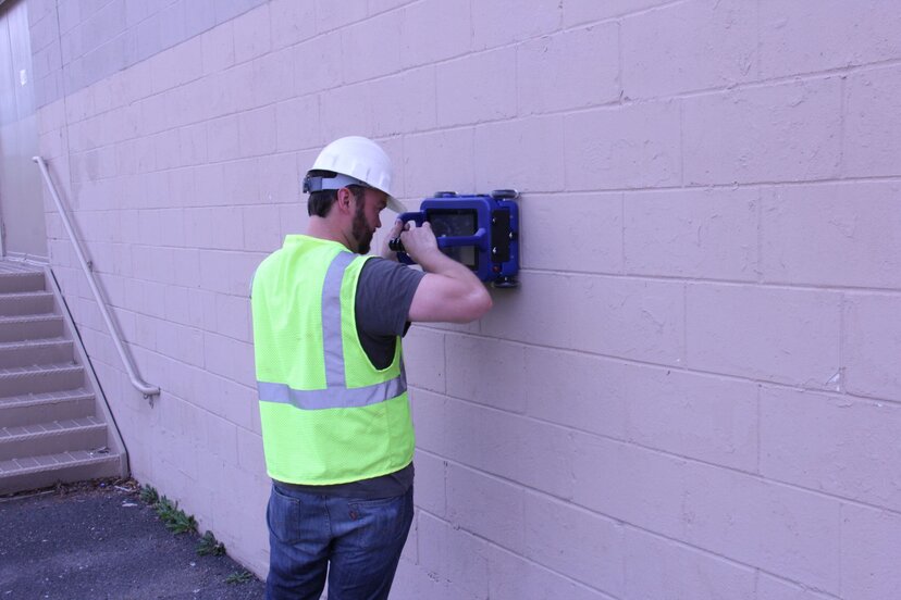
To conduct a GPR survey, you need the right equipment for the job at hand.
All-in-one systems provide everything you need to scan areas of the ground. With a little training, anyone can position and wheel these systems over survey areas, collecting data that can be used to make various decisions. Modular systems are designed to mount on trucks, ATVs and other vehicles, so you can easily cover the ground you’re scanning. And concrete scanning options come in handheld models that make it easier to scan inside buildings to find out what’s under concrete flooring or inside of walls.
Whatever system you choose, it’s important to ensure you’re equipped with the right components for the job. You’ll need a transmitter that sends signal into the ground and a receiver that accepts the feedback signals that tell the GPR technology what’s below and where. You also need technology that converts all that data into something you can use to make decisions or understand what’s under the ground or beyond concrete barriers. That may mean investing in the right GPR software solutions for your purpose.
What Are the Outputs of a GPR Survey?
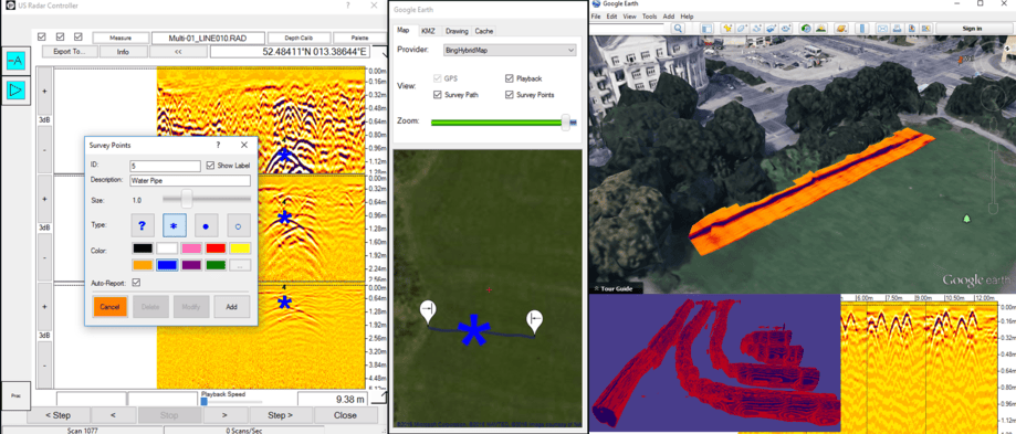
The exact outputs of a GPR survey depend on the tools you’re using.
- The GPR technology used during survey activities is constantly collecting data about the structure of things under the ground. This data may be output in a variety of formats that you can feed into your own analytical systems or statistical analysis processes.
- If the solutions you’re using have integrated GPS options, the outputs can include data about exact locations. That can help you better pinpoint the locations of various structures, obstructions or other formations of interest.
- Most GPR survey software solutions output an image. Images help you see the size, shape and placement of various items below the surface you’re surveying. Experience with GPR readouts can help you easily identify items such as concrete barriers, metal or plastic pipes, air pockets and voids in the soil, rocks and other formations.
- Some survey solutions offer 3D imaging that models the subsurface and helps you get an even better idea of how formations and other items below ground fit together.
GPR Survey Benefits

GPR surveys are a go-to solution for many types of applications due to the benefits afforded by the technology. Here are some benefits you can expect from GPR surveys.
- Horizontal accuracy. GPR is fairly accurate, especially when it comes to the horizontal placement of items below ground. If you couple GPR technology with GPS, you can get an even better capture of where, horizontally on the landscape, an item is located. This lets teams understand where to dig if they want to uncover items or where not to dig or build if they’re trying to avoid infrastructure.
- Detects both conductive and non-conductive materials. Radar is actually the only remote sensing technology that can do this, giving GPR surveys a leg up on other methods if detecting both types of materials is a need.
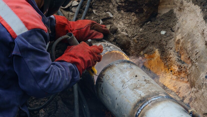
- Wide-ranging applications. GPR surveys work in a variety of applications, including utility mapping and construction surveys, some infrastructure inspections, environmental or geophysical research, and mapping out archaeology or grave sites.
- Easy to use. While you do need some experience to interpret the images on a GPR readout to know what they might be, the equipment itself is easy to operate. Most people can operate the US Radar all-in-one solutions, which roll over the ground almost like a lawnmower, with only a short amount of training.
- Decent depth range. How deep GPR signals can penetrate depends on factors such as soil conditions and type, how many obstructions are in the area and the strength of the antenna. Penetration can range from 15cm to 30m.
- Safe for use in most locations. The frequencies used in GPR surveying are not inherently dangerous, so you can use the technology in public areas. The tech doesn’t usually interfere with other processes, but it’s always important to be careful around dangerous construction, industrial or mining zones.
- Fast access to data. GPR surveys deliver immediate data that can be viewed in the field. That reduces the time it takes to analyze an area and make a decision about digging, building or other processes. You can also save the data for review by others, which supports ongoing research or planning for projects.
- Doesn’t require digging. In most cases, you don’t have to dig to conduct a GPR survey. Not having to disturb the ground makes it possible to use this technology over landscapes that shouldn’t be damaged and conserve the pristine nature of an environment if you’re just conducting research.
- Cost-effective compared to competing methods. GPR technology tends to be less expensive than similar technologies. For information on pricing related to US Radar systems and software, contact us today.
Limitations of GPR Surveys
GPR surveys are not without limitations, though. If the near surface of an area has a large amount of heavy clay, the penetration depth of GPR may be measured in centimeters instead of meters. That can leave a lot of mystery left to what’s under the ground.
Another potential limitation of GPR is that it doesn’t always pass through everything below. If the frequencies hit a large metal pipe, for example, they may not detect two smaller plastic pipes running below the metal one.
Because of this, it’s important to be aware of limitations and account for them when analyzing survey results.
Get Started With GPR Surveys

US Radar offers a wide range of GPR survey equipment and GPR software. Our teams also provide tech support and training to help you get the most out of your survey solutions. If you need to know what lies beneath and can’t or don’t want to start digging, contact us today to find out more about GPR survey solutions.


