

Without the right tools, locating a buried object is a frustrating endeavor. Depending on the object you’re looking for and the material it’s made out of, it could require probing soil, digging endless holes or drilling in cement. There are always metal detectors, of course, but if the object you seek isn’t metal, those aren’t much help. Fortunately, there’s a better approach to finding buried objects.
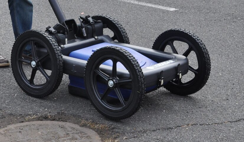
Ground-penetrating radar, or GPR, is a geophysical method that produces a cross-sectional profile of subsurface materials noninvasively. When fitted to a mobile cart and paired with other technologies, it lets operators scan and image ground, cement and other materials to discover what lies below the surface. In other words, you can use it to locate a variety of buried objects without ever needing to probe, cut, dig or drill.
Go ahead and put away the pickaxes, power tools and metal detectors and read on to find out how to find where a buried object is with GPR.
How GPR Works to Locate Buried Objects
The main component of GPR is an antenna that transmits pulses of electromagnetic energy into the ground. When these waves pass through materials, they reflect back to the antenna. Using a computer to process the information from the reflected waves, we can understand what’s below the surface:
- The reflection pattern indicates the shape of an object.
- The differences in electromagnetic properties provide clues about its material.
- The time it takes for the wave to travel between the object indicates the depth.
While GPR has been in use since the 1970s, it wasn’t until the last few decades that the technology progressed enough for commercial applications. These days, most GPR solutions are fitted to carts with digital displays. A single operator rolls the cart over the surface to understand what’s buried below.
What Can I Locate With GPR?
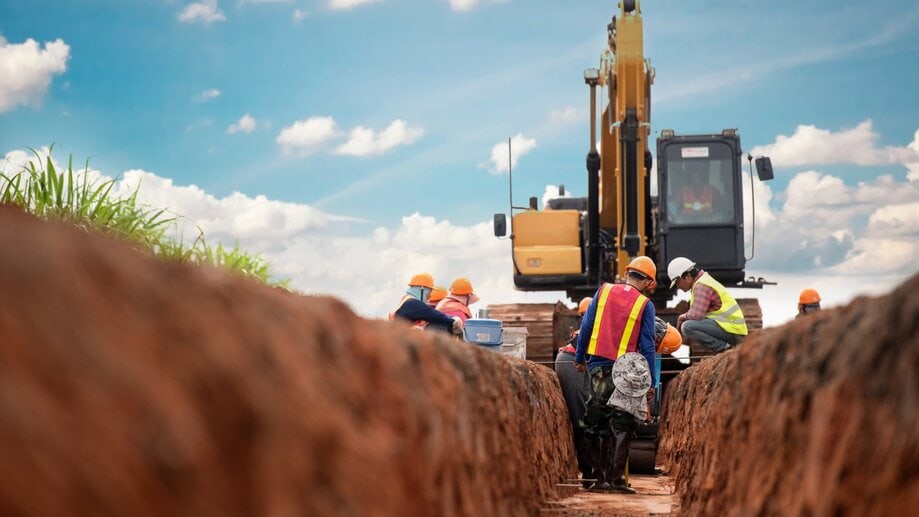
Given its incredible versatility, GPR is used across countless industries. From civil engineers and construction professionals to archeologists and environmentalists, professionals in various niches find the technology useful for analyzing subsurface materials in a noninvasive manner.
Some of the many things operators use GPR to locate include:
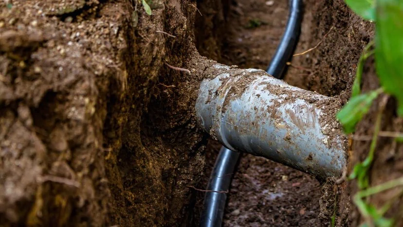
- Utility cables, such as electricity or communication lines
- Pipes and plumbing, including water mains, gas lines and septic systems
- Underground structures, such as tunnels and mines
- Buried artifacts such as those found on archeological digs
- Gravesites, whether archeological or clandestine
Additionally, because GPR works on the principle of electromagnetic waves, it also locates a lack of material, such as underground voids, sinkholes, cracks and depressions. The only things that are difficult for GPR to locate are objects that share the same electromagnetic properties as the surrounding ground material, which is quite rare.
Where Can I Use GPR?
To provide accurate measurements of the subsurface material, GPR solutions require multiple scans of the surface area. This means the operator needs enough space to walk back and forth and scan the area repeatedly. For the same reason, GPR is difficult to use effectively on especially uneven terrains. That said, it works in just about any environment you can safely roll the cart around in.
As for specific surfaces and areas, GPR works on and in:
- Dirt, soil and grass
- Gravel and rock
- Pavement, concrete and asphalt
- Construction areas
- Archeological dig sites
- Prairies, pastures and fields
- Forests
- Your backyard
How to Locate Buried Objects With GPR

Using a GPR to measure, map, analyze or locate objects is generally referred to as surveying. And if you want the best possible results, you need to plan your survey. It also requires a little bit of work depending on the size of the area you’re surveying. But before you even start planning, you need to ask yourself a few questions that determine your survey’s strategy.
- What is the object I’m searching for?
- How big is the object?
- What kind of material is the object made of?
- How deep is the object buried?
- What kind of surface material am I scanning?
- How big is the area I’m surveying?
If you can answer any or even all of these questions, you’ll considerably improve your chances of success. Even if you can’t answer any of them, GPR is still useful for locating the unknown. But you may need to employ various strategies across multiple surveys.
Planning Your Survey
The most important part of any survey is the planning stage. Taking into account the information you know about the object you’re searching for, weigh your options and decide on the best possible approach. There are some major variables you’ll need to consider before narrowing down your options:
- The object in question
- The size of the survey area
- The amount of detail required
- The surface material of the survey site
It works like this: GPR builds subsurface images based on the data collected from multiple passes of the survey site. These passes are called scan lines, and they’re organized in a grid pattern. Before you start scanning, you’ll plan your grid and use markers to indicate where your grid starts, where it stops and where your scan lines are.
Generally speaking, the closer together your scan lines, the more detail you have about what’s in the ground. If you’re attempting to locate a power line in a relatively small area and you know which direction the line runs, you won’t need too many scans. And as long as you scan perpendicular to the line’s path, you won’t need to scan from two directions.
Conversely, if you’re searching for relatively small objects in a larger area, you’ll need tighter scan lines in your grid. Otherwise, you may miss the objects if they happen to be in an area in between two scan lines. If you’re searching for an object you could confuse for other objects you aren’t searching for, you’ll need more detail. That means more scan lines.
The final consideration is surface material. GPR does have its limitations. Because it depends on electromagnetic waves for imaging, highly conductive materials cause the radio waves to disperse. This decreases the depth and detail of GPR. So, if the material you’re scanning has excessive water content, you may need to increase your scanning amount or wait for a better opportunity to conduct your survey.
We Can Help
Ground-penetrating radar is hands-down the best non-destructive or non-invasive approach for locating buried objects. With the right solution and the right planning, you can find nearly any object in nearly any material. Whether you work in the construction industry, archeology, environmentalism or law enforcement, GPR can help you find what’s buried beneath the surface. If you’re curious about what else GPR can do for you, we’d like to talk.
At US Radar, we’ve worked hard for almost 30 years to design, engineer and build the best commercial GPR solutions on the planet. Countless professionals in a multitude of industries trust our products to help them map, measure, analyze, image and survey subsurface materials. They also count on our global network of helpful representatives to provide the support and training they need and answer their questions when they need answering. If you’d like the answer to the question of how GPR can work for you, get in touch with us today.


